

Chicago weather: Springlike storms today give way to snow and colder air
Springlike storms today give way to snow and colder air in Chicago
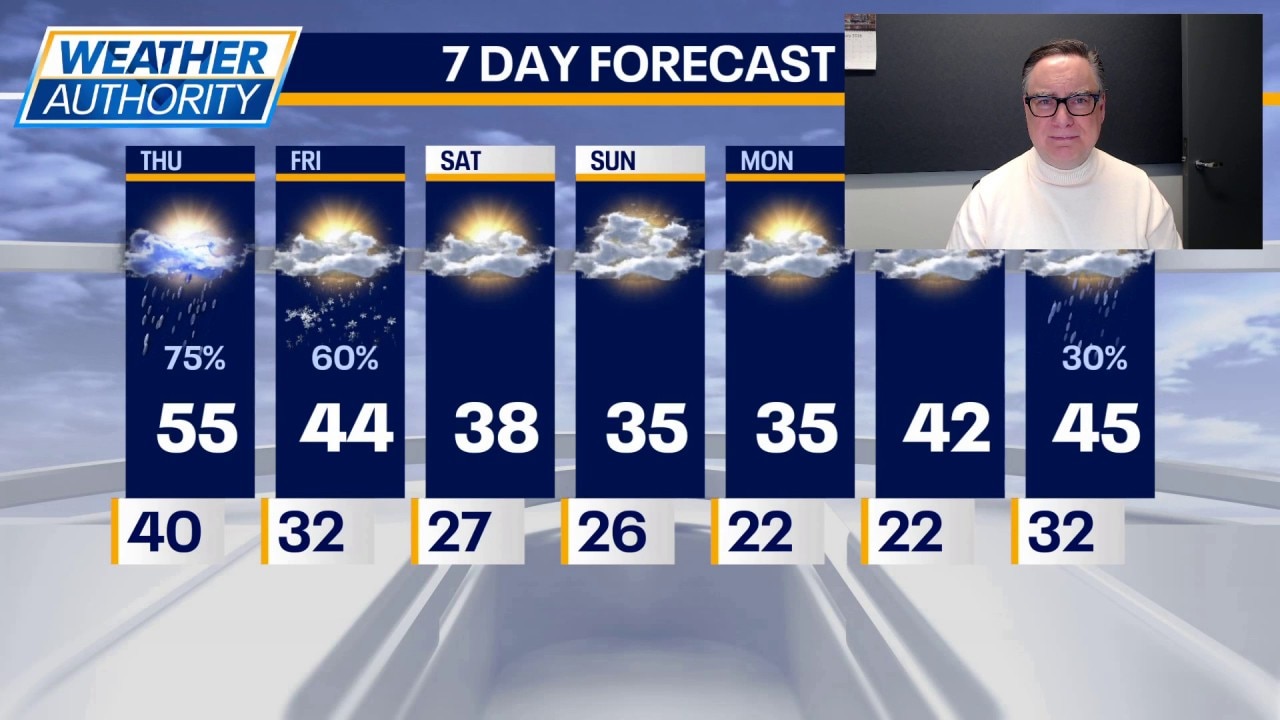
Chicago will see a springlike round of thunderstorms today before colder air moves in, bringing a chance of snow and a return to February chill.
CHICAGO - There is finally some actual February in this forecast.
Today, however, we start with a more spring-like set up, which will lead to scattered thunderstorms. There are already a few storms that have popped up well south of the Kankakee river. While there can be a shower or storm at almost any time of day, late afternoon and evening will be prime time for activity. Some of those storms could be strong to possibly severe.
Before that hits, it will be mostly cloudy with high temperatures varying greatly across the area. Most of us will hit the 50s, but it will be cooler at the lake and warmer as you had well southwest of Chicago.
Tonight, thunderstorms will move north through the area and end late as our plummet into the 30s. After that, the wraparound portion of the storm system will swing through tomorrow morning, when it will be just cold enough for at least some snow to fall. It may coat the ground in some spots with a deference to the higher totals being northwest of Chicago. Any precipitation tomorrow will end later in the morning, leaving behind a blustery and colder day with temperatures in the 30s.
That colder regime will last through the weekend and into Monday, when skies will be partly to mostly cloudy with highs in the 30s and lows in the 20s.
The next warming trend is on the way starting Tuesday when we return to at least the 40s.
The Source: The information in this forecast came from FOX Chicago's Mike Caplan.