

Lake-effect snow could add another 3 inches Thursday in Chicagoland
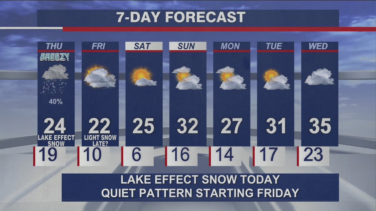
CHICAGO - If you didn't shovel your driveways and sidewalks, you might want to. Chicagoland could see up to three more inches of snow Thursday.
Temps are below freezing Thursday morning, and any leftover snow could turn a bit icy.
A Winter Weather Advisory has been issued until 6 p.m. Thursday. The National Weather Service in Chicago said there is a threat to life or property in central, southern and northern Cook County.
Wednesday's snow has poured across the Chicagoland area, leaving up to 11 inches in some areas.
Thursday, it will be cloudy with dashes of light snow in areas outside of Cook County, and a second wave of snow near Kankakee.
Highs will be in the 20s, and tonight, temps will fall near 10 degrees across the area.
Here in Chicago, expect some lake-effect snow moving in this morning that could dump an additional 1 to 3 inches of snow.
The official snowfall for Chicago from Wednesday’s storm was 5.6 inches at O’Hare International Airport, the most this winter. Areas around Midway Airport got 11 inches.
Lansing recorded 12.5 inches, Pontiac 10 to 12 and, in Indiana, 10 to 13 inches in Lake and Porter counties. They were the highest snowfall totals in northern Illinois and northwest Indiana since the middle of February last year.
About two dozen states have some form of a winter weather advisory in areas.
The Sun-Times Media Wire contributed to this report