

Chicago weather: Storm chance tonight before cooler Wednesday settles in
Chicago weather: Storm chance tonight before cooler Wednesday settles in
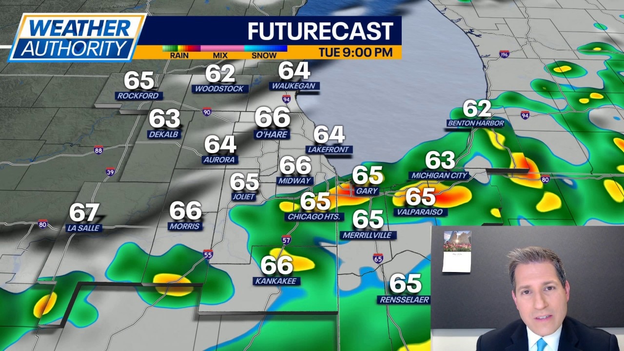
JD Rudd has your weather update!
CHICAGO - The warmer air was short-lived for some of our northern locales today, thanks to rain and a cold front. Meanwhile, our southern areas saw highs soar into the upper 70s and lower 80s. There is still a chance for a few thunderstorms to bubble up prior to midnight, with the best odds near the Illinois and Indiana state line.
Once we get beyond midnight, expect any rain and storms to push off to the east and temperatures to slip into the upper 40s and lower 50s. It won't be nearly as chilly/cold as last night.
Looking ahead:
Wednesday brings decreasing clouds and cooler air, with highs topping out around 60 in most cases. We'll also have a northwest breeze holding around 10-20 mph through the day.
As we move into the second half of the week, things start to warm up. Thursday is looking fantastic with sunshine and highs in the middle 60s. Wind speeds around 5-15 mph. Then, on Friday, we should warm into the middle 70s with morning temperatures near 50. There is a chance for showers on Friday, but it looks to be mainly in the morning.
The weekend is still shaping up to be toasty with highs well into the 80s, morning lows around 60. Both days feature a chance for rain and storms, but Sunday has the better shot. And, it's possible we see some strong to severe storms, so stay alert Sunday.
Warm air hangs with us into the start of next as highs hang near 80 with continued chances for rain and thunderstorms. But looking further ahead, another cooldown may be coming around the end of next week.