

Chicago weather: Heavy rain returns after a brief break
CHICAGO - It’s the calm before the storm today.
After drenching thunderstorms hit parts of Chicagoland yesterday, we await the next round of heavy rain, which is due here tomorrow. More on that momentarily.
Heavy rain and cooler weather
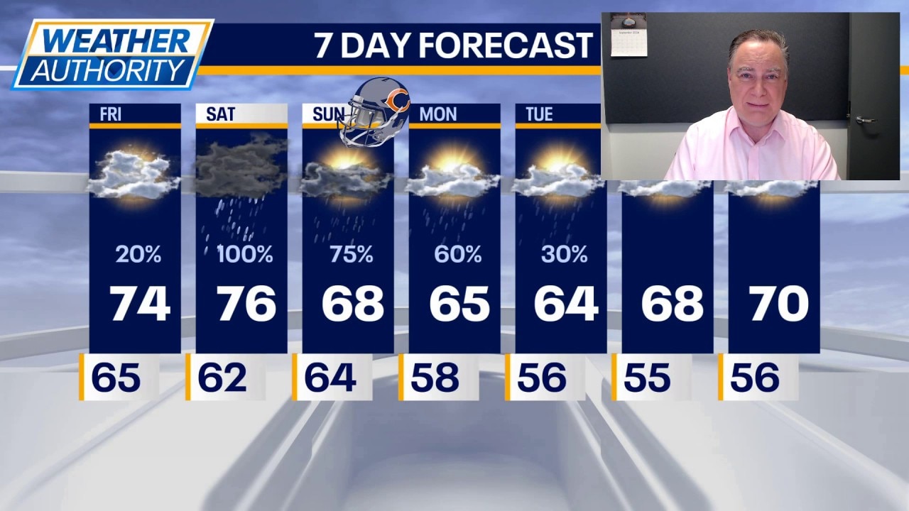
Today will be mostly cloudy, but there will be some sunshine breaking through. High temperatures will only be in the low 70s, but it will still be rather humid.
What's next:
Tonight looks dry, but during the wee hours of Saturday morning, showers and thunderstorms could invade the area. Showers and storms are a virtual certainty later in the morning into at least the early afternoon hours. Flooding downpours will be possible almost anywhere in Chicagoland, but perhaps with a bias this time for the northern half of our viewing area.
Showers and storms can redevelop in the afternoon into Saturday evening during which time there is a low end chance of a gusty storm mixed in. High temperatures will be in the mid 70s in between rains.
Showers and perhaps a few thunderstorms remain likely on Sunday. High temperatures may not get out of the 60s on Sunday, which would be the first time Chicago has failed to hit 70 since June 26.
Showers are still possible on Monday, which appears to be a cool day with highs in the mid 60s. Cooler-than-normal temperatures continue next week with drying conditions starting on Wednesday.
This rain comes amid developing drought conditions across all of Chicagoland. Yesterday‘s update from the US Drought Monitor showed all of our viewing area deemed "abnormally dry." That only takes into account precipitation through Tuesday. Almost certainly all of that dryness will be erased when next week’s drought update is released Thursday morning.
The Source: The information in this forecast came from FOX Chicago's Mike Caplan.