

Chicago weather: After severe storms, a dangerous stretch of heat is on the way
Chicago weather: After severe storms, a dangerous stretch of heat is on the way
JD Rudd has your weather update!
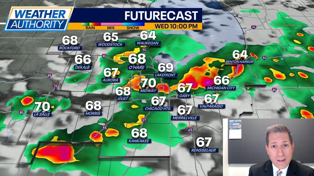
CHICAGO - A wet morning turning into a stormy afternoon and evening. Some locales have seen wind damage due to severe storms producing wind gusts near 70 mph. We even had rotation spotted on the radar, prompting one tornado warning near Carpentersville and Huntley.
Scattered thunderstorms will continue across parts of the Chicago area through at least the midnight hour tonight, with the activity moving to the southeast with time.
A few of these storms may still produce wind gusts near 60 mph and/or hail around quarter to even golf ball size. Aside from that, pockets of very heavy rain are expected and that could lead to some localized high water. Don't be surprised by the amount of lightning and thunder either; these storms may grab attention as they move through.
Beyond midnight, the storms push out and leave the area. In their wake, clouds may linger (along with some humidity) and lows around 60. The wind is expected to drop off and that may aid in the development of some fog in spots, especially closer to Lake Michigan.
Full forecast:
Thursday brings decreasing clouds and highs in the upper 70s. It's looking more like the best chances for any rain may stay just to our south.
Rain and thunder chances may return on Friday ahead of a fresh push of warm air. Prior to that, highs Friday may stop in the middle 70s. Then, as we start the weekend, highs will jump into the lower 80s. Along with that, the dew points will go up, making it feel warmer.
The heat begins to nose its way in on Sunday with highs near 90 in many spots. Dew points will climb to near 70 and that's going to push the heat index close to 100 degrees. Given the heat and humidity, we could end up with strong thunderstorms Sunday evening and night.
As we go into next week, a real heat wave is expected to grip the area for several days. Highs will soar to the middle 90s Monday through at least Wednesday. Heat index values topping 105 degrees are looking very possible. That kind of heat will be dangerous to some. Plan now and find a way to keep cool next week.