

Chicago weather: Cold Tuesday gives way to spring warmth
Cold Tuesday gives way to spring warmth across Chicagoland
Mike Caplan has your Chicago weather update!
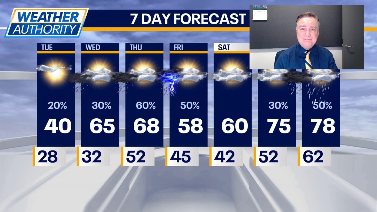
CHICAGO - Let’s hope this is the last really cold day for a while!
We’ll start with some cloud cover, especially near the lake. Skies will clear and we’ll see a good deal of sunshine later today. It will not help much with temperatures however, which will spend most of the time in the 30s topping out around 40. Highest chance of getting past 40° will be in our southern and western counties.
Tonight we’ll see increasing cloud cover and temperatures that drop to around freezing before starting to rise overnight. A few light showers are likely during the wee hours of the morning, getting out of the way for the rest of Wednesday.
Highs tomorrow will be much warmer than today reaching the mid 60s with a gusty wind. The next chance of showers arrives late tomorrow night into Thursday morning and will be followed by partly sunny skies with highs in the upper 60s.
What's next:
A cold front will move into the area on Friday and with it will likely be some showers and thunderstorms Thursday night into early Friday. Severe storms are not expected at this time. Highs on Friday will be knocked down about 10 degrees, especially near the lake. It’s looking increasingly likely that most of, if not all of the upcoming weekend will end up being rain-free.
Highs on Saturday should be close to 60 and then soaring well into the 70s on Sunday. Highest chance of any rain over the weekend would be Sunday night into Monday with Monday being another very warm day with highs well into the 70s.
The Source: The information in this forecast came from FOX Chicago's Mike Caplan.