

Chicago weather: Wednesday storms could bring tornadoes, widespread damage
Chicago weather: Wednesday storms could bring tornadoes, widespread damage
JD Rudd has your weather update!
CHICAGO - Chicagoland is gearing up for what looks to be a day of very disruptive weather on Wednesday.
Currently, all indications suggest that we see several severe storms that will bring a threat for damaging wind gusts and tornadoes.
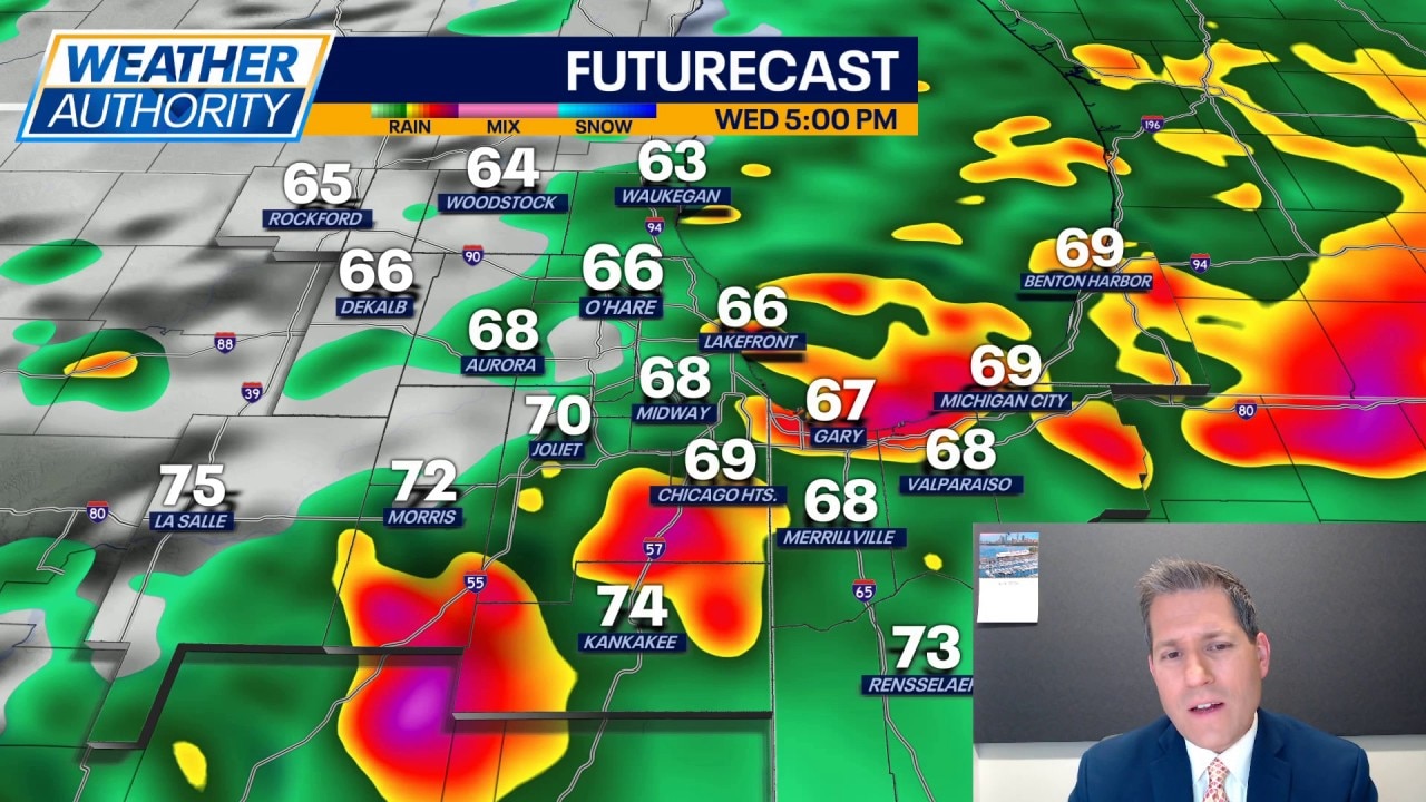
Wednesday's forecast:
- Morning - Pockets of rain and a few rumbles roll into our western locales. Severe weather is not expected.
- Midday - A widespread swath of heavy rain and thunderstorms may move through. There may be a few stronger storms in this batch and wind gusts would be the prime concern.
- Afternoon into evening - This is where we have to watch for rapid development of individual storm cells. If we get those, they could quickly start to rotate and produce tornadoes. The dynamics are in place to see violent, long-track tornadoes in our southern counties (areas along and south of I-80). In addition to that, some storms may carry wind gusts topping 70mph at times.
Given the multiple rounds of rain, we could end up seeing rainfall total around 3" to 4" by the end of the day. Localized flooding and high water is possible. Be mindful of the lightning risk with these storms as well.
Ultimately, for Wednesday, we may end up with widespread damage and power outages due to these storms. Be prepared and have a way to get alerts. Make sure your phones are charged as well.
Now, all of that said, should the midday rain and storm action linger longer across the area, it may help to reduce the severe weather threat for the evening. And, any sunshine we see will only fuel the atmosphere for storms.
Looking ahead:
Thursday brings decreasing clouds and dry conditions with highs in the lower 70s. Sunshine and mid 70s on Friday into Saturday.
Sunday looks to be wet with rain expected through much of the day; highs will hold in the middle 70s.
The early part of next week looks quiet with a partly cloudy sky and highs remaining in the 70s.