

Chicago weather: Strong storms roll in after summerlike warmth
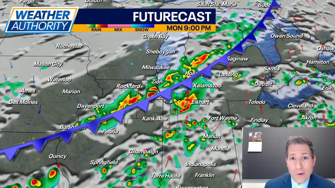
CHICAGO - After a day that saw many spots with highs near 80 degrees, we're now tracking a strong cold front cutting into the Chicago area. That front is helping to fire off pockets of rain and thunderstorms.
LIVE UPDATES:
- Severe Thunderstorm Warning issued for LaSalle, Kendall, Grundy counties until 8 p.m., NWS says. The baseball game at Wrigley Field between Cubs and the Reds is set to begin at 7:50 p.m., team officials say.
- A double rainbow was sighted in the Chicago-area after heavy rain and strong storms passed through on Monday.
- Severe Thunderstorm Warning issued for Will County until 7:45 p.m., the NWS says.
- Severe Thunderstorm Warning issued for LaSalle County until 7:30 p.m., the National Weather Service says.
- Wrigley Field has announced tonight's game between the Cubs and the Reds is in a weather delay until further notice.
- Ground stop in effect at O'Hare airport until 7 p.m.
- Severe Thunderstorm Warning issued for LaPorte County, Ind. until 6:30 p.m.
Monday's storms:
We have already seen some of those storms turn strong to severe, with damaging wind gusts the primary concern. The threat for tornadoes is very low but not zero, so we'll need to monitor things closely.
Otherwise, expect a lot of thunder and lightning with the stronger storms, as well as some downpours. Localized minor flooding is possible. And several of these storms may feature some small hail.
Expect the bulk of storms to clear the area shortly before midnight. At that time, the threat for severe weather will be over. But we won't be done with rain as showers may make a return around daybreak Tuesday. By then, much cooler air will have spilled into the area.
Looking ahead:
Clouds will be stubborn Tuesday but some sun may break through at times. Sun or not, it's going to be around 20 to 25 degrees cooler with highs only in the mid to upper 50s. Lakefront areas may be several degrees cooler. It does appear that we should dry things out after mid morning.
The cooler air looks to hang around for the middle of the week with highs holding in the upper 50s for Wednesday and Thursday with a mix of clouds and sun.
By the end of the week, warm air tries to make a return with highs in the middle 60s Friday and then jumping into the 70s on Saturday. Morning lows climb into the middle 40s both days as well. As we get to Sunday, highs drop back into the middle 60s (which is near normal for this time of year) and there is a chance to see a few showers and rumbles.
The Source: The information in this article was reported by FOX Chicago meteorologist JD Rudd.