

Chicago area to see up to 6 inches of snow Monday, followed by brutal cold snap
(Photo by Scott Olson/Getty Images)
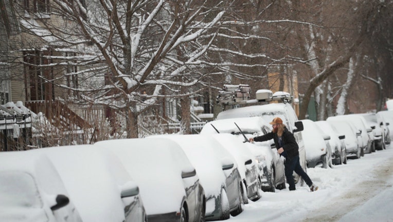
CHICAGO (Sun-Times Media Wire) - Another formidable bout of snowfall is heading to the Chicago area Sunday night, possibly dumping 4 to 6 inches of snow before temperatures are expected to plummet to dangerous levels the region hasn’t seen in years.
Starting 11 p.m. Sunday and ramping up drastically after 1 a.m. Monday, snow will arrive in northeast Illinois as winds tear through at speeds as high as 30 mph, according to the National Weather Service.
The highest chances of snowfall, exceeding half a foot, are predicted in the northernmost suburbs, close to the Wisconsin border, the NWS said.
Cook, Kane, DuPage, Will, Grundy, LaSalle and Kendall counties will remain under a winter weather advisory from 9 p.m. Sunday until 6 p.m. Monday, the weather service said. Additionally, Lake and Porter counties in northwest Indiana will be under the same advisory from midnight until 6 p.m. Monday.
The weather service warned of difficult travel conditions and advised motorists to use caution while navigating slippery roads with limited visibilities. Drivers are warned to look out for blowing snow and heavy travel delays during the Monday morning commute.
As of 1:25 p.m. Sunday, 28 flights had already been canceled at O’Hare International Airport and 17 more had been grounded at Midway International Airport, according to the Chicago Department of Aviation. Average delays at both airports were lasting less than 15 minutes.
There will be one silver lining for Chicagoans, however: temperatures will rise to 35 degrees by 10 a.m. Monday, offering a brief respite before they dive back to subzero values, the weather service said.
The city’s Monday afternoon temperatures will stay in the low-20s before dipping back to zero degrees at night, the NWS said. Windchill values will be as low as 11 degrees below zero that evening.
The mass of cold air slated to arrive in northeast Illinois around then could be the coldest in years, the NWS said. Windchill values could fall below minus 40 in some areas this week.
The last time the region weathered temperatures this low was Jan. 18-20, 1994, when Chicago recorded a windchill of minus 21, the NWS said.
On Tuesday, the city is predicted to endure a high of 3 degrees in the day and a low of 19 degrees below zero at night, the weather service said.
Though a partly sunny day is forecasted for both Tuesday and Wednesday, the high will likely be minus 11 the latter day, the NWS said. That night, temperatures should drop to a low of 18 degrees below zero.
The cold should relent Thursday at the earliest — though there is a chance of snow both Thursday and Friday, the NWS said.