

Chicago weather: Cool finish to the week before dangerous heat arrives
Chicago weather: Friday morning forecast
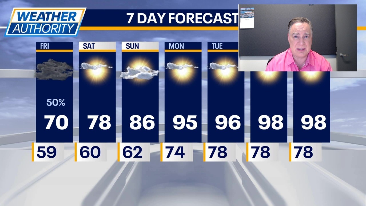
Fox Chicago Meteorologist Mike Caplan breaks down today's weather forecast.
CHICAGO - We’ve got two more days of cooler-than-normal temperatures and then it’s crank up the heat. And that means we’ll all be cranking up the air-conditioning starting Sunday and then big time next week. More on the heat wave in a moment.
Chicago weather forecast
What we know:
Today there is some rain downstate as of this writing and that will be moving north during the morning. Question remains how far north will that rain reach. It still looks like the heaviest rain will fall south of Interstate 80.
Thunderstorms are not expected. Because of increased cloud cover and the rain in the area, highs today may struggle to hit 70 degrees. Any rain will move out of the area tonight leaving behind partly to mostly cloudy skies and lows around 60°. Tomorrow will be partly sunny and mild with highs in the mid to upper 70s. It will be a bit cooler near the lake and warmer in our southwest counties. Chances for rainfall tomorrow night look even lower than they have all week long.
If I had to pick a part of Chicagoland most likely to see any rain tomorrow night into the wee hours of Sunday, I would say far southwest of the city.
Very warm weather arrives on Sunday with highs in the mid to upper 80s and a palpable uptick in humidity. The blow torch is underway though on Monday and lasts all of next work week with highs in the mid 90s and enough humidity to make it feel like it’s close to 105° most afternoons.
Any chance for thunderstorm activity to briefly cool things off is looking less likely. This will be a bona fide heat wave and alerts will likely be required for some or all of the Chicago area.
The Source: The information in this report came from Fox Chicago Meteorologist Mike Caplan.