

Chicago weather: Lake effect snow will bring impacts to Chicagoland Thursday and Friday
Chicago weather: Lake effect snow will bring impacts to Chicagoland Thursday and Friday
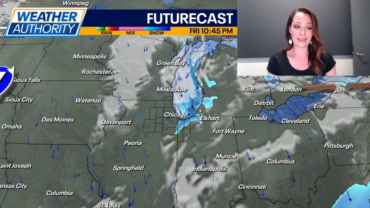
Emily Wahls has your weather update!
CHICAGO - Cold air is here to stay through the end of the week and lake effect snow will bring impacts to parts of Chicagoland Friday and Saturday.
Expect another cold night with lows near zero and wind chills as low as -5 to -15. Skies will be mostly clear and that will set us up for a sunny start to our Thursday.
Full forecast :
Tomorrow will be similar to today with sunny skies and highs in the mid-teens. Northwest winds will range from 5 to 10 mph during the day, keeping wind chills in the low to mid single digits.
Lake effect snow is expected to ramp up late Thursday night or early Friday morning, lasting through Saturday. Northeast Illinois will likely be the most impacted during the day on Friday, and then the heavier lake effect bands will shift east into northwest Indiana Friday evening and night.
Accumulations will be heavily dependent on how long the dominant lake effect bands sit over any specific area, but the forecast should become a little clearer as we get closer to it.
Lake effect snow will continue through Saturday with highs in the lower 20s. Skies will dry out on Sunday with many areas rising into the mid, possibly upper 20s.
Temperatures will be much more tolerable next week with highs in the upper 20s to near 30 degrees on Monday and Tuesday.