

Chicago weather: Multi-day heat wave brings highs in the 90s through Friday
Chicago weather: Multi-day heat wave brings highs in the 90s through Friday
JD Rudd has your weather update!
CHICAGO - We kick off a new workweek with an old pattern: sunny and hot. Highs hit the lower 90s today with all of that sunshine. And while the humidity wasn't super thick, it still felt fairly muggy. That feel is going to continue tonight. Expect a clear sky, calm wind and lows near 72.
The biggest difference between this heat wave and the one from two weeks ago is the humidity. Dew points will hover in the upper 60s this time, as opposed to the middle and upper 70s last time. That results in heat index values closer to 100 instead of 110.
Looking ahead:
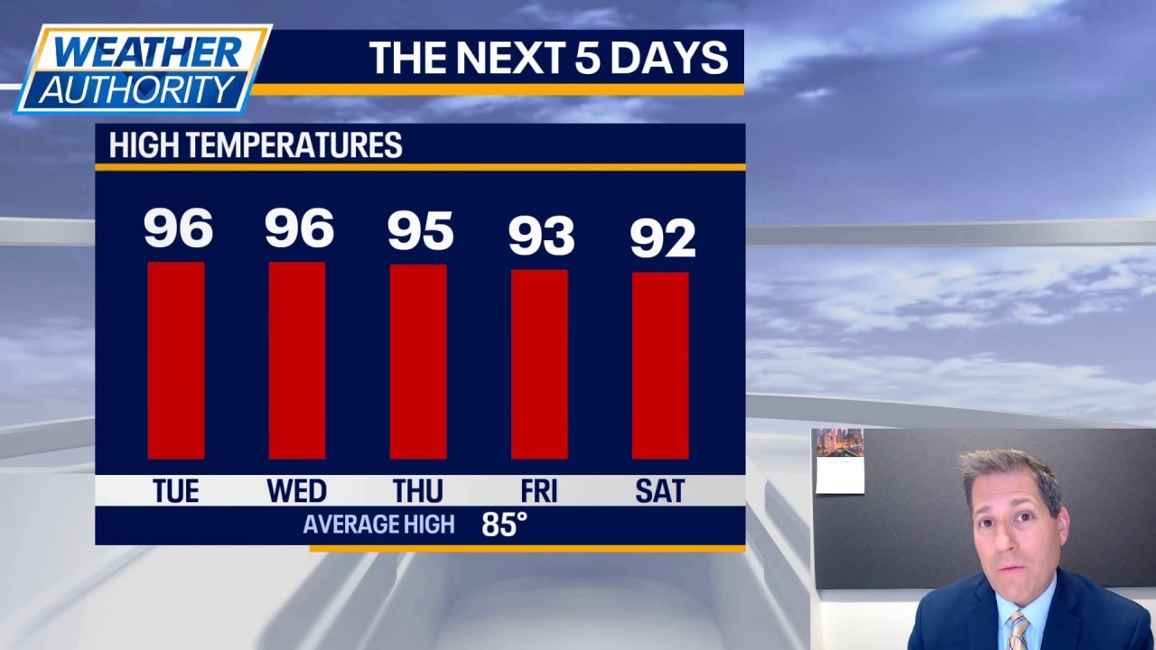
More sunshine and more heat on Tuesday. Matter of fact, it could be the hottest day Chicago has felt all year. Highs are expected to be around 96 degrees (the hottest so far has been 95). Toss in the humidity, and heat index values will be around 100 degrees. Don't plan on the wind to help cool you down, as speeds will likely stay around 5-10 mph through the day.
Sunshine and hot once more on Wednesday with highs back in the middle 90s. The humidity may climb a bit more, pushing heat index values closer to 105 degrees. Morning lows will be in the middle 70s.
The parade of 90s looks to continue into Thursday and Friday with low to mid 90s expected. Dew points will slip, resulting in heat index values a bit closer to the air temperatures.
The major takeaway for the workweek is to find ways to remain cool and keep properly hydrated (which would include drinking about 16 oz of water every hour).
There is a shot at some spotty thunderstorms Friday evening and again Saturday evening. If the timing is correct, it's possible we see some strong to severe storms those days. Highs will still be in the lower 90s and morning lows in the middle 70s.
Heading into Sunday and early next week, we could see readings dip closer to the upper 80s (which is still pretty warm).