

Chicago weather: Severe storm threat misses city, flooding concerns remain
Chicago weather: Severe storm threat misses city, flooding concerns remain
Fox Chicago's JD Rudd has the latest forecast.
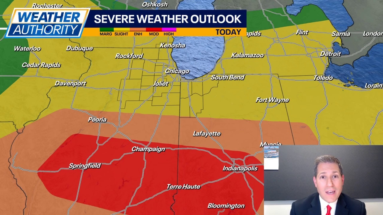
CHICAGO - We prepared for the worst and thankfully, it did not happen here. The lingering midday rain helped to hold the dangerous storms to our south today (a scenario we discussed as being possible yesterday). However, parts of Illinois have been hit with tornadoes today, mainly from Peoria to Springfield and Champaign. That's where the better setup remains tonight for large-scale severe weather.
That said, it's possible northern Illinois sees a couple of spotty storms before 10pm that produce wind gusts and heavy rainfall. This would be on top of the roughly one to two inches of rain many spots picked up earlier today. Stay alert to localized high water and flooding this evening. Otherwise, we dry out overnight but keep a strong breeze. Lows will hang near 60 in most spots.
As we go into Thursday, we begin the day with clouds, but those clouds will break for some sun in the afternoon. A spotty, pop-up shower cannot be ruled out in the afternoon. Highs look to top out in the low to middle 70s with very little humidity.
Friday and Saturday are still shaping up to be dry with sunshine and highs in the upper 70s to near 80. By Sunday, wet weather returns to the area. It could be an all-day soaker for some spots, so maybe have a backup plan if you want to do something outside. Rainfall amounts could top one inch in spots. Highs Sunday may struggle to get into the 70s. Not ideal for the official start of summer!
Next week remains comfortable with highs staying in the mid to upper 70s under a fairly sunny sky. Lows will remain in the mid to upper 50s.