

Chicago weather: Severe storm threats return to region
Chicago weather: Tuesday afternoon forecast
Fox Chicago Meteorologist Kaitlin Cody breaks down today's weather outlook.
CHICAGO - Today we have the chance for strong to severe storms. It is gusty either way, with non-thunderstorm winds of up to 30-40 mph.
Severe weather threat
What we know:
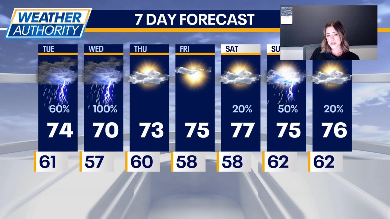
The best chance for severe weather is in northwest Indiana where a slight (level 2/5) is in place. Chicago, and counties straight south are under a marginal risk (level 1/5). Temperatures will be in the mid 70s this afternoon.
What's next:
Tomorrow will be the day to watch for severe weather. The chance for storms starts early in the morning and lasts until late evening (roughly 6 a.m.-9pm). The best chance for severe storms is between 3pm-9pm. All hazards are possible tomorrow including strong tornadoes. The best chance leans toward our southern counties again.
Highs Wednesday will be around 70. Things will be quiet Thursday with partly sunny skies and highs in the low to mid 70s. Friday will. be sunny with highs in the mid 70s.
This weekend will be in the 70s! Saturday will be mostly sunny with highs in the upper 70s. The chance for storms is back Saturday night through Sunday night. Sunday will be partly sunny with highs in the mid 70s under partly sunny skies.
We start next week with partly sunny skies and highs in the upper 70s on Monday.
The Source: The information in this report came from Fox Chicago Meteorologist Kaitlin Cody.