

Chicago weather: Latest on Thursday's sticking snow

Chicago weather: Latest on Thursday's expected snowfall
Today will be the 12th day in a row with above average temperatures, but don't get used to it. Areas of Chicago could see several inches of snow on the ground by tomorrow afternoon.
Chicago - Pitchers and catchers report to spring training today. It seems especially appropriate because it feels like spring here in Chicago lately.
Today will be the 12th day in a row with above average temperatures. It has felt more like March than February the past several days, but don't get used to it.
We officially have just under two weeks left of meteorological winter. It appears we will sneak in some snow and colder temperatures the final part of February. The latest forecast model runs have bumped up snowfall totals a bit for Thursday.
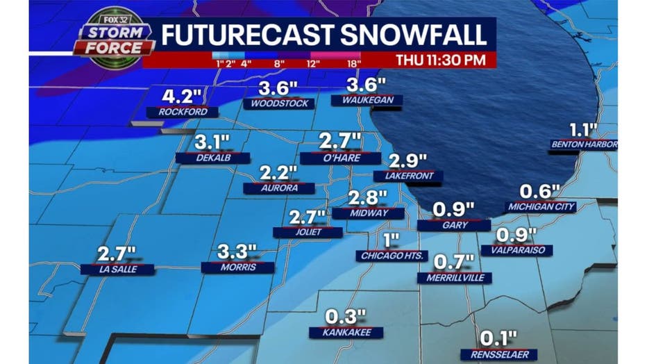
Our Fox Model has most of northern Illinois seeing about 1 to 3 inches of snow with heavier amounts well north of Chicago. Northern Lake and McHenry County could see nearly 4 inches of snow according to this model.
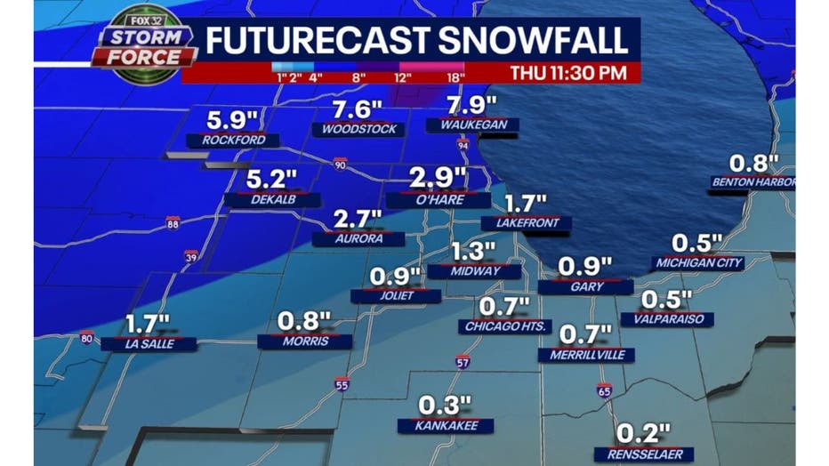
The GFS Model is keeping snowfall under an inch for most areas south of the city. It is now calling for 5 to nearly 8 inches of new snow for the far northern and northwest suburbs. I'm thinking the actual snowfall may be a blend of these models. We should see a bit more than the Fox Model is forecasting but a bit less than the GFS Model.
I expect a dusting to maybe an inch for areas south of the city then increasing to 4 to 6 inches well north of Chicago with most areas getting something between, around 1 to 4 inches.
SUBSCRIBE TO FOX 32 ON YOUTUBE
This would make snow lovers happy. So far this February we have seen just a trace of snow. On average, February is the second-snowiest month of the year with just under 11 inches normally falling.
Any snow this week will put a dent in our snowfall deficit, but we have a long way to go to catch up with average. Since Dec. 1, just over 13 inches of snow have been reported at O'Hare. That is nearly a foot below average through this part of winter.
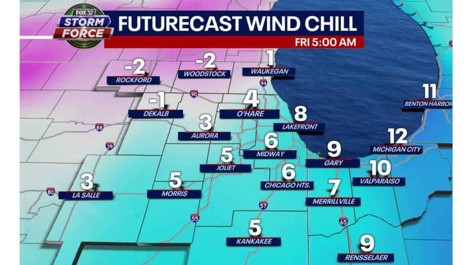
It will certainly feel more like February by Friday. Wind chills will dip to near or even below zero just before daybreak. Even colder air could be coming before the end of the month.

Our Fox Model high temperature forecast looks like a rollercoaster again today. We fall from the 50s today to the 20s for highs by Friday. A warmer weekend ahead with highs back into the 40s, and then we head back downhill and below average by the end of next week. Highs drop back into the 20s a week from this Friday.