

Chicago severe weather: Tornadoes, large hail and damaging winds possible today
Chicagoland tornado threat: Severe weather expected, timeline
Kaitlin Cody has your Chicago weather update!
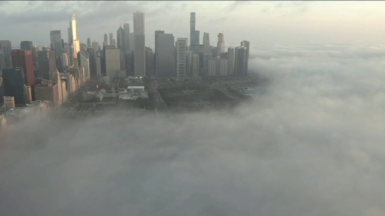
CHICAGO - We are in for a busy day in the weather department today. This morning we have a dense fog advisory for Kane, DeKalb and McHenry counties until 11 a.m.
All attention this afternoon through tonight will be the chance for severe storms. The storm prediction center has I-88 and points south at an enhanced (level 3/5) risk and there is a slight risk (level 2/5) for roughly I-88 points north.
The risks of storms will be from 2-3 p.m. until around 1 a.m., with the chance for severe storms to continue into early tomorrow for locations south of I-80.
Severe storm threats
With the chance for severe storms, threats include:
- Damaging hail (>2" in diameter)
- Damaging wind to 70mph +
- Tornadoes which may be strong
- Localized flash flooding
Temperatures this morning will be the high for some. In Chicago, temperatures are expected to drop into the 40s by this afternoon. We will be watching the location of the frontal boundary causing this temperature drop, as it will be the divider between those who have the better chance for tornadoes (warmer temperatures).
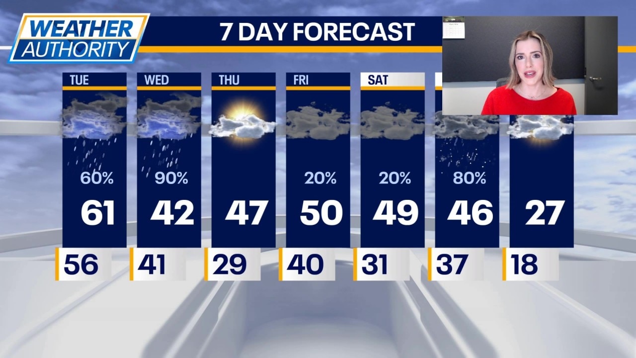
Chicago weather: Tuesday morning forecast
Fox Chicago Meteorologist Kaitlin Cody breaks down today's weather outlook.
What's next:
Tomorrow will be colder with temperatures in the 40s. There is a chance for rain to mix with snow, especially north.
Thursday, we finally get a break with sunshine and highs in the upper 40s. It is expected to get gusty Thursday night, and there is a chance for rain. Friday will be partly sunny with highs around 50.
This weekend will be cloudy with highs in the upper 40s to near 50 degrees. There is a chance for rain Saturday afternoon and night. A rain/snow mix is possible on Sunday.
Mostly cloudy skies to start next week, but it will be cold. Highs on Monday will be in the upper 20s.
The Source: The information in this report came from Fox Chicago Meteorologist Kaitlin Cody.