

Chicago weather: A few strong to severe storms could develop on Thursday
Chicago weather: A few strong to severe storms could develop on Thursday
Fox Chicago's Emily Wahls has the latest forecast.
CHICAGO - It was another very warm day by February standards with afternoon temperatures soaring into the low to mid 60s.
Fox Chicago Chief Meteorologist Emily Wahls has the forecast.
What to Expect:
Skies will be partly cloudy tonight with lows in the upper 30s to low 40s. Increasing cloud cover is expected Thursday morning, and then we'll be on the lookout for showers and storms as another storm system approaches the area.
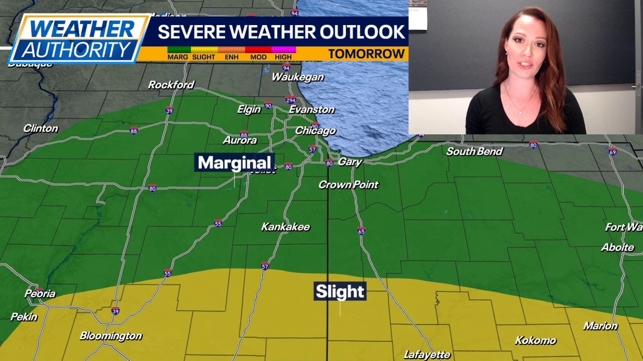
The Storm Prediction Center has most of Chicagoland in a Marginal Risk for severe storms on Thursday, which is a level 1 of 5. The far southern portions of Newton and Jasper Counties are in a Slight Risk, a level 2 of 5. While the overall threat for severe storms appears low, if all the elements come together just right, we could be at risk of isolated damaging wind gusts, hail, and possibly even an isolated tornado Thursday afternoon through early evening.
Much colder air will wrap into the area Thursday night and Friday. Friday's high temperatures will likely be set in the early morning hours in the mid 40s, and then daytime temps will slip into the 30s. A few rain/snow showers will be possible on Friday, especially in the morning.
The weekend will be seasonably chilly with highs in the mid to upper 30s on Saturday and then near the freezing mark on Sunday. Northwest Indiana may see some lake effect snow showers on Sunday.