

Chicago weather: Dense fog, drizzle slow morning commute
Chicago weather: Friday morning forecast
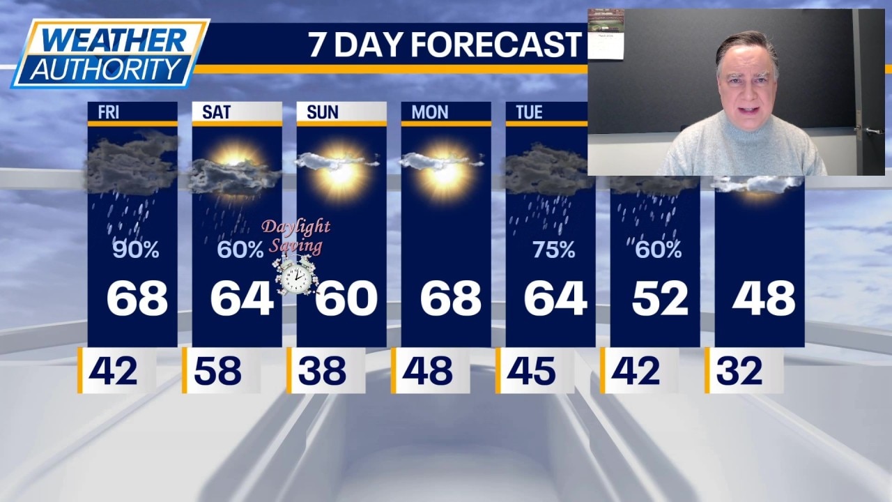
Fox Chicago Meteorologist Mike Caplan breaks down today's weather outlook.
CHICAGO - There is much to discuss regarding Chicago weather over the next 24 to 36 hours.
First things first. Dense fog is once again a problem for all of Chicagoland with an advisory in effect until 10 a.m. this morning. There will be some patchy drizzle too.
What we know:
Later this morning, an area of showers and thunderstorms will cross at least parts of our area, likely favoring the northern half of our area. Some additional shower and thunderstorm activity is possible at almost any time today but an additional round of more organized showers and storms appears likely this evening. Some could be strong.
Thunderstorms remain possible even tomorrow morning when there is likely going to be a line crossing the area. Again, any of those could be strong. In between all of this, a surge of unseasonable warmth is on the way. There will be a spread in temperatures across our area with upper 50s and low 60s near the lake and in our northern counties while temperatures will soar into the mid 70s well south of I-80. If we hit 70 degrees officially it would tie a record set most recently in 2000. I think the official high comes up just a couple of degrees short of that record.
After the storms exit tomorrow morning, the rest of the day will be windy with temperatures falling from morning highs in the low 60s into the 40s during the afternoon. Skies will be clearing and the stage will be set for a lovely second half of the weekend when Sunday has plenty of sun and highs around 60.
Monday looks spectacular with plenty of sunshine and highs in the upper 60s. The next storm system arrives late Tuesday into Wednesday with showers and perhaps a few thunderstorms and a bit of a cool down with Wednesday’s highs in the 50s.
Daylight Saving Time begins Sunday at 2 a.m. so set those manual clocks ahead an hour at bedtime Saturday.
The Source: The information in this report came from Fox Chicago Meteorologist Mike Caplan.