

Chicago weather: Extreme heat continues before holiday weekend storm chances
Extreme heat grips Chicagoland before storm chances arrive for holiday weekend
Mike Caplan has your Chicago weather update!
CHICAGO - Welcome to July!
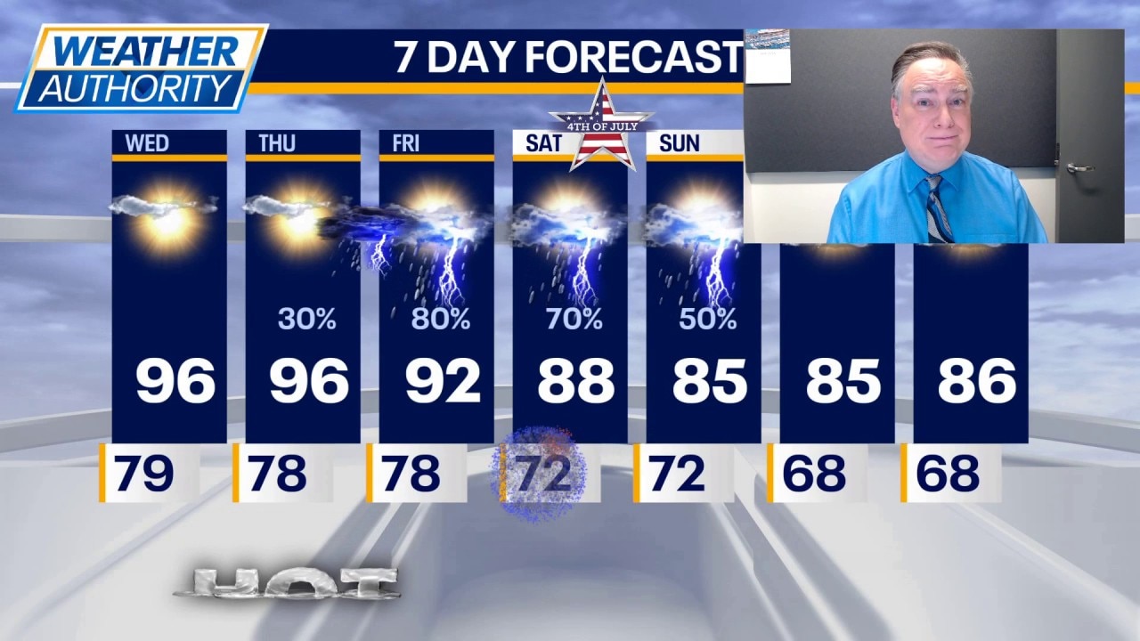
If you remember yesterday, you know pretty much what to expect today. Once again, it will be very hot and very humid with high temperatures reaching the mid 90s and a peak heat index somewhere between 100-110. Our extreme heat warning continues unabated through Thursday night.
What's next:
During the day tomorrow, we will have abundant sunshine with highs again in the mid 90s and similar heat indexes. Tomorrow night presents our first opportunity to get a shower or thunderstorm in the area. In fact, it’s possible that any storm late tomorrow night into early Friday could be strong to severe.
A chance of showers and thunderstorms will continue Friday, Saturday, and even Sunday. Those with outdoor plans will need to monitor the forecast closely over the holiday for impact due to rain and thunderstorms. This will also have an impact on temperatures. While it certainly won’t be cool, it won’t be as hot.
I still think we have a chance of hitting 90 on Friday, but over the weekend it will be more like the mid to upper 80s. While widespread severe thunderstorms are not expected over the weekend, it is not out of the question that some stronger storms could occur.
We closed the books on June. Temperatures were almost exactly normal and rainfall ended up being about 1 inch wetter than normal.
The backstory:
An interesting side note: yesterday’s low temperature was 79° at O’Hare. That was only 1° away from a record warmest low and is one of the warmest nights on record during the month of June.
The Source: The information in this forecast came from FOX Chicago's Mike Caplan.