

Winter storm warning in effect for Chicago as lake-effect snow ramps up
CHICAGO - A winter storm warning is in effect for the city of Chicago as lake-effect snow intensifies.
What we know:
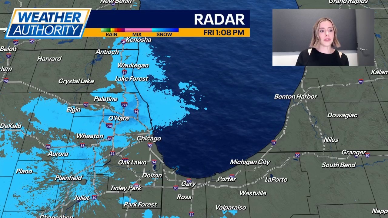
Snow began falling in the northern suburbs this morning before spreading across much of the Chicago area into early afternoon.
At times, snow may fall at a heavy rate, leading to some travel difficulties.
The city of Chicago has now been upgraded to a winter storm warning through midnight. Central and southern Cook County could see 6 inches or more of snow, especially closer to the lake.
Chicago weather: Heavy lake-effect snow targets Cook County, northwest Indiana
Kaitlin Cody has your weather update!
Heading into the evening hours, it will be northwest Indiana getting hammered by the lake-effect snow. A winter storm warning will be in effect starting at 3 p.m. for Lake and Porter counties. These areas could easily get more than a half foot of snow between tonight and tomorrow.
Highs today will be in the upper teens again.
Lake-effect snow will continue tomorrow, possibly sloshing back to the Chicago side, but with less intensity. Nevertheless, there could be some travel impacts at some point tomorrow as the snow finally winds down during the late afternoon hours.
What's next:
Tomorrow will be in the mid 20s with again, lake effect snow as mentioned above. Sunday will be sunny with highs in the mid 20s. There is a chance for snow Sunday night.
Monday will be mostly cloudy with highs near 30. Temperatures will be around 30 Tuesday with mostly cloudy skies and afternoon snow. The chance for snow continues Tuesday night and Wednesday.
Wednesday will be around 30 with mostly cloudy skies. Thursday will be mostly cloudy with highs in the low 30s.
The Source: The information in this forecast came from FOX Chicago's Mike Caplan.