

Chicago weather: Lake-effect snow to kick off weekend
Chicago weather: Thursday morning forecast
Fox Chicago's Mike Caplan breaks down today's weather outlook.
CHICAGO - Today will be frigid again as we start with temperatures around zero and wind chills well below.
What we know:
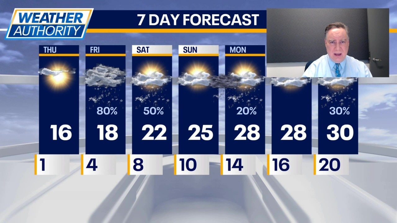
Chicago will have plenty of sunshine today, but once again it will have a little effect on temperatures with highs stuck in the mid to upper teens.
Tonight we will see partly cloudy conditions with an increase in cloud cover near the Lakeshore by daybreak. This will be the beginning of lake-effect snow, which will move into Chicagoland during the morning and have at least some impact on the commute.
At this point, it seems likely the snow will start in Lake County, Illinois, and slide south during the morning and afternoon, eventually pointing at Northwest Indiana by evening. There can be disruptions to travel as this band migrates across our area. Snowfall rates could exceed 1 inch per hour.
By Friday night, the focus is squarely on Northwest Indiana, where a Winter Storm Watch is in effect. This will need to change to either a warning or an advisory. Temperatures will be holding fairly steady in the teens.
The snow will continue on Saturday and it appears most likely that it will remain in Indiana at a weaker intensity level. It is possible that the snow may back up into Chicagoland briefly during the day. Highs on Saturday should get into the lower 20s and be in the mid 20s with partly sunny skies on Sunday. That night and Monday there is a chance for some additional light snow, but it does not appear like a big storm at this point. Temperatures will remain below normal into next week.
The Source: The information in this report came from Fox Chicago Meteorologist Mike Caplan.