

Chicago weather: Quick-moving system will bring snow overnight
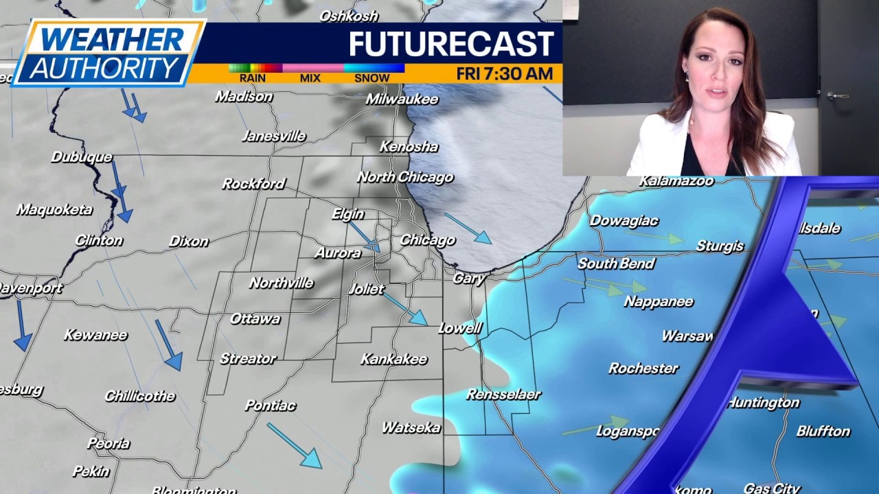
CHICAGO - A quick moving system will bring snow to the area in the early morning hours of Friday, likely ending shortly after daybreak.
Most areas are looking at an inch or less or accumulation, but a few isolated locations could see an inch and a half to two inches near the lake. The heaviest snow rates will be between 3-7 AM. Any untreated surfaces will become snowy and slick.
Full forecast :
Scattered snow showers remain a possibility through the day on Friday, although coverage will be limited. High temperatures will be in the mid to upper 30s.
Colder air moves in Friday night with lows plummeting to near 10 degrees. Inland locations will easily fall into the single digits. Saturday looks cold with partly cloudy skies and highs in the low to mid 20s.
Skies become partly sunny to mostly cloudy on Sunday with temperatures warming to near normal in the lower 30s.
The real warm-up arrives early next workweek with highs soaring into the low 40s on Monday and then mid 40s on Tuesday. Skies will be mainly dry early in the week, and then a low chance of rain arrives on Wednesday.