

Chicago's February warm streak ends with wind advisory, falling temps
Chicago’s February warm streak ends with wind advisory, falling temps
Mike Caplan has your Chicago weather update!
CHICAGO - We’ve just finished a week during which every day made it at least into the 50s and three days made it into the 60s. In February!
We have also had 11 days in a row of above average temperatures and today will likely be day 12 even as colder air overspreads the area.
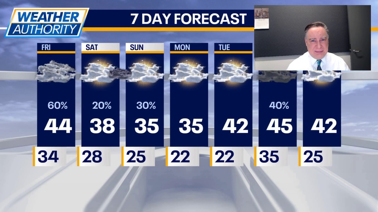
We’ve already had our high for the day and our temperatures will be dropping into the 30s. There could be a few light snow showers in the area this morning and a flurry or sprinkle at almost anytime today, but accumulations are not expected — especially on anything paved.
The main feature today will be the strong winds, which have warranted a wind advisory for most of the day. Gusts at times may exceed 40 mph. Tonight will be mostly cloudy, breezy and colder with lows in the upper 20s.
What's next:
Over the weekend, February will be in full force. Highs on both days will be in the 30s. Skies will be mostly cloudy and there are a couple of opportunities for some light snow. That’s in addition to some lake-effect snow for parts of northwest Indiana.
Monday will be cold again, but the next warming trend is in sight and starts Tuesday when a string of 40s begins.
The Source: The information in this forecast came from FOX Chicago's Mike Caplan.