

Chicago weather: Cold sticks around but signs point to warmer days ahead
CHICAGO - Happy Groundhog Day! It’s still going to be colder than normal for most of the upcoming week, however, it will be a different brand of cold from what we endured the past couple of weeks. There are also some signs of a bona fide thaw arriving next week.
What we know:
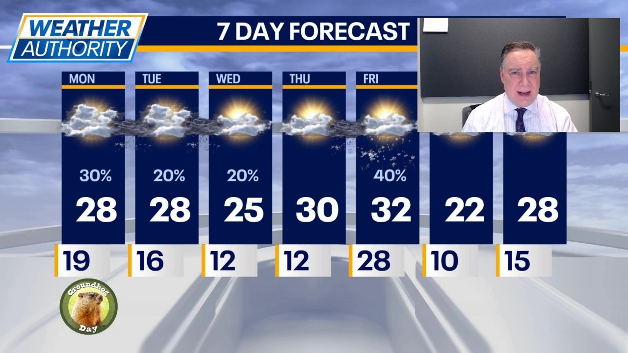
Let’s focus on the early morning hours. There is currently some light freezing drizzle and snow working through the area. This could be enough to create slippery spots on untreated surfaces like sidewalks and driveways. The rest of the day will just be mostly cloudy and chilly with highs in the upper 20s. Tonight will be mostly cloudy with a small chance for a period of light snow overnight. Lows in the mid to upper teens.
What's next:
Tomorrow will be partly to mostly cloudy with highs in the upper 20s again. There’s another small chance for a light snow shower overnight. On Wednesday it may be a couple of degrees colder with partly sunny skies.
On Thursday we may hit 30° for the first time in forever. And on Friday there’s a chance we get a couple of degrees past freezing for an hour or two. There’s a chance for a bit of light snow Thursday night into Friday.
A quick shot of cold air does arrive this weekend with highs mainly in the low to mid 20s. After that, temperatures may swing significantly upward next week. Fingers are crossed.
The Source: The information in this report came from Fox Chicago Meteorologist Mike Caplan.