

Chicago weather: Heat index near 100, severe storms possible Wednesday and Thursday
Chicago weather: Heat index near 100, severe storms possible Wednesday and Thursday
JD Rudd has your weather update!
CHICAGO - We have seen some needed rainfall in many spots today, and coming down in buckets at times. Thankfully, no severe weather. Those pockets of rain and thundershowers will slowly taper tonight. However, a few returning showers and rumbles are possible early Tuesday.
The humidity has surged across the area, making it feel pretty thick out there. It remains warm and muggy through the night with lows around 70.
Looking ahead:
Much of Tuesday will be dry but very warm and muggy. Highs will climb well into the 80s, with heat index values in the lower 90s due to the high humidity. A southwest wind around 10-20 mph may help a little bit, but not much. Expect a mainly cloudy sky with some peeks of sun at times. By late Tuesday, a few thunderstorms may try to press into the area ahead of our next system.
Here's your heads up: Wednesday is going to be a miserably hot day. Air temperatures will move into the 90s and then, with the high dew points (humidity), heat index values may hit 100 degrees. Not ideal for those who plan to be outside for long periods of time.
With that heat and humidity, we do have chances for thunderstorms. There may be two rounds, with the first coming in the early morning hours Wednesday. Those should move out quickly and not be too widespread. However, later in the day, we may see another round of storms move in. That round has the potential to produce some strong to severe activity, so stay alert.
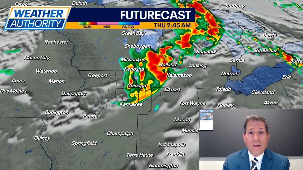
Thursday brings another threat for severe weather and this may be the greatest threat of the week. Timing on this is still in flux, but it appears to be an afternoon to evening setup where a large storm complex rolls in. All hazards are possible: damaging wind gusts, large hail, and tornadoes. The finer details will be smoothed out as we get closer to Thursday and it's still possible the threat could shift.
Aside from the storms, it will remain very warm and still humid. Morning lows in the 70s and highs in the upper 80s.
Heading into the end of the week and weekend, temperatures will hang in the 80s for Friday and Saturday, but the humidity will be less. We could see a few showers Saturday night as a cold front moves in. Behind that front, noticeably cooler air arrives for Sunday with highs in the 70s. Sunshine and lower 70s are expected on Monday of next week with lows slipping into the 50s. The humidity drops off for Sunday and Monday.