

Chicago weather: Morning snow, afternoon thaw and gusty winds
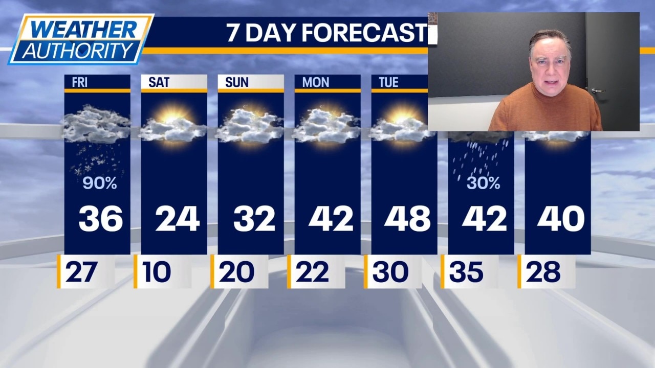
CHICAGO - It’s a heck of a way to run a warm-up! Today will be warmer than it has been in three weeks. But before we get to those mid 30s, we have to deal with some snow this morning.
Snow arrives
What to expect:
It certainly won’t be a big storm but flakes will be falling while many folks are heading out. Most of Chicagoland will end up with 1 inch or less and the snow should be ending by mid-morning.
The wind will pick up and temperature should get into the mid 30s this afternoon. As a cold front drops in from the north, there will likely be some additional snow showers later this afternoon and those might impact the afternoon commute.
Lake-effect snow could impact Porter county east into early tomorrow. Tonight’s temperatures will drop into the single digits away from the city.
What's next:
A quick shot of cold air will be in place tomorrow with highs in the mid 20s.
On Sunday we should get close to or perhaps a little bit above freezing. Both weekend days will be partly to mostly cloudy. The big warm-up arrives next week with highs in the 40s and a realistic shot of hitting 50 degrees on Tuesday.
There might be some rain on Wednesday.
The Source: The information in this report came from Fox Chicago Meteorologist Mike Caplan.