

Chicago weather: Warming pattern holds steady
Chicago weather: Tuesday morning forecast
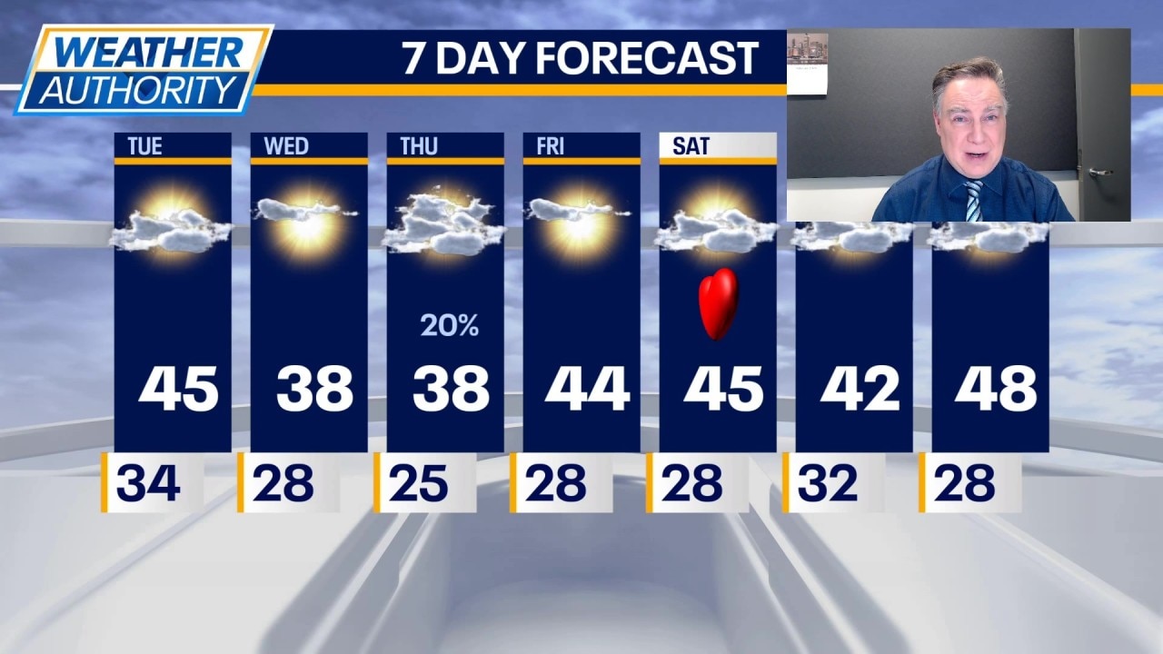
Fox Chicago Meteorologist Mike Caplan breaks down today's weather outlook.
CHICAGO - The daily melt continues uninterrupted well into next week. In fact, temperatures next week could be significantly warmer than normal, but let’s not put the cart in front of the horse just yet.
What we know:
Today will be partly to mostly cloudy and a few degrees warmer than yesterday with low to mid 40s likely. It will be windier today behind a cold front that has no real cold air behind it. Tonight will be mostly cloudy and seasonably chilly with lows in the mid to upper 20s.
It won’t be quite as warm on Wednesday, but it will still be warmer than normal with mostly sunny skies and highs in the upper 30s.
On Thursday there remains a small chance for some light precipitation, perhaps a combination of rain or wet snow particularly well southwest of Chicago.
Otherwise, it will be mostly cloudy with highs again in the upper 30s. Then it’s time to move back into the 40s starting Friday and continuing through the weekend under partly cloudy skies.
Over the weekend a storm system continues to look as though it will miss the area safely to the south.
The Source: The information in this report came from Fox Chicago Meteorologist Mike Caplan.