

Cool to cold Chicago pattern may become milder soon
Chicago - Monday will be the fifth-straight day with below average temperatures as highs hit the middle 60s. Average highs for the latter part of September are in the lower 70s.
This is a reversal compared to the start of September. The start of the month was well above average. Before our cool streak, 17 of the first 21 days were above average. The month is running nearly three degrees above average overall.
The cool pattern that kicked in on Thursday will get colder the next few days, but long range forecasts suggest a flip to a milder fall patter could be coming soon.
SUBSCRIBE TO THE FOX 32 YOUTUBE CHANNEL

www.barrybutlerphotography.com
High temperatures for the next five days in a row are forecast to be cooler than average. Lows will actually fall at least into the 40s for many of us the next few nights. Patchy frost may form in some areas well away from the city by early Wednesday morning and again early Thursday morning.
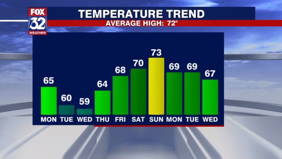
A flip in our pattern begins this weekend. Four out of the five last days in the 10-day temperature trend forecast should have highs above average. The fifth day in that group, a week from Wednesday, should be right around average.
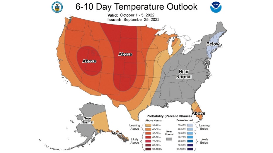
The longer range forecasts favor us for a relatively mild start to October. The Climate Prediction Center's 6-10 day has us outlooked to be "leaning above" average overall from this Saturday through Wednesday of next week. Average highs by the end of this period slide to 68 degrees.
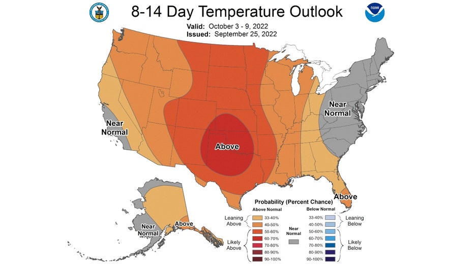
The 8-14 day temperature outlook keeps the milder pattern coming. This forecast also has us "leaning above" average overall from next Monday through the following Sunday.
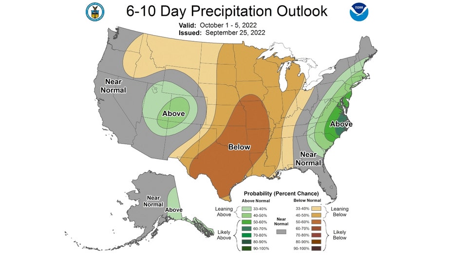
We are favored to be milder than average and drier than average overall in both longer range forecasts. The 6-10 day precipitation outlook has us "leaning below" average in precipitation.

The 8-14 day outlook also has us "leaning below" average in precipitation too.