Bitter cold is coming for Chicago
CHICAGO - The last time the Chicago area had a month end up being below average in terms of temperature was way back in July. December has gotten off to a relatively mild start for the month. So far this month is just over 3 degrees above average.
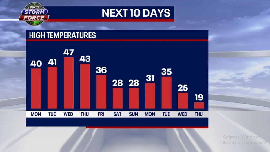
Colder air is coming for Chicago with a major pattern change right around the corner. Today will be the eighth-straight day with above average temperatures. That streak should stretch to eleven straight above average days as we are expected to remain relatively mild through Thursday.
Our model has the bottom beginning to drop out on Friday as highs fall into the middle 30s. Friday may feel frigid for some of us but if the forecast pans out, the high of 36 degrees would be right at average. The colder pattern collapses our highs into the middle to upper 20s this weekend. Those temperatures will be nearly 10 degrees below average. The high forecast for a week from this Thursday of just 19 degrees would be just over 15 degrees below average. Wind chills could dip into the teens by Friday evening and into the single digits by Saturday night.
Millennium Park https://www.barrybutlerphotography.com/
The long-term forecasts from the Climate Prediction Center hints this chilly pattern could continue right into Christmas. The 6-10 day temperature outlook has us forecast to be "likely below" average overall from this Saturday through the following Wednesday.
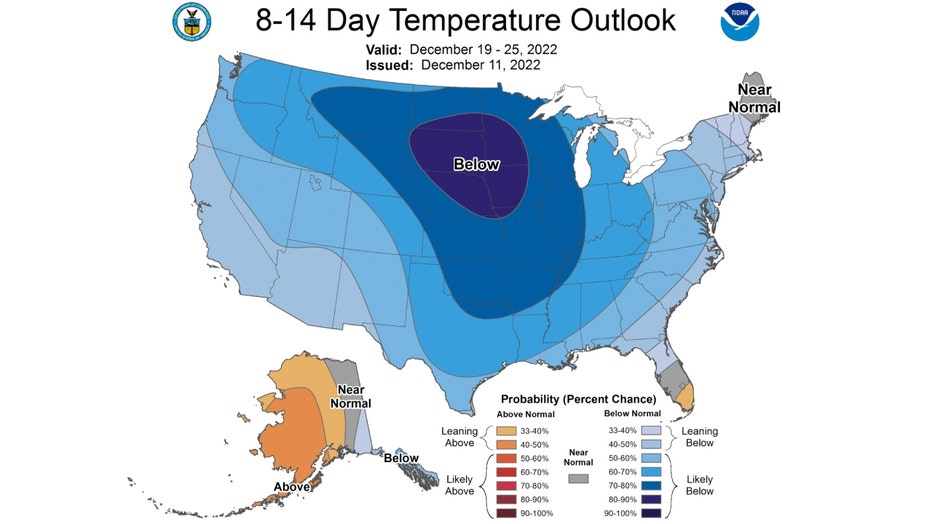
The 8-14 day temperature outlook keeps the colder air coming right through Santa's big day. We have even higher probability of being below average overall next Monday through the following Sunday (19th-25th).

This flip to a colder pattern is good news for snow lovers who have not had much to be excited about thus far. Since Oct. 1, we have seen just 1.3 inches of snow at O'Hare or just 25% of average snowfall for the period.