

Chicago severe weather threat: Tornadoes possible, flood watch in effect
LATEST STORY: Live and ongoing updates as the storms roll in. Tap here.
CHICAGO - While there is certainly a high ceiling for severe weather in our viewing area today, there are also several failure modes in which severe thunderstorms become less likely.
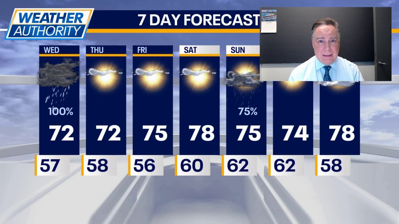
We open with showers and thunderstorms moving into our area by mid-morning from the west. There is a chance of strong winds with this activity along with heavy rainfall. Perhaps the higher risk of severe weather with this initial wave will remain displaced well to our southwest. This is enough to warrant the beginning of a flood watch for our viewing area, which will continue into the evening.
How this early activity evolves will dictate to at least some measure what happens in the afternoon and early evening. This will require us to keep a close eye on forecast trends because the potential exists for part of our area to have tornadoes.
I believe there will be a distinct southern bias towards the strongest storms this afternoon, particularly south of I-80. This does not mean that there can’t or won’t be severe weather north of that highway. All this being said, there is a chance that all the severe weather this afternoon targets Central Illinois. Our weather team will be on top of this and provide necessary updates through the day and early evening.
The risk of severe weather should exit or viewing area around 8 p.m. This will be followed by a period of tranquil weather for a few days.
Live severe weather updates
- A Tornado Watch has been issued for Grundy and LaSalle counties until 3 p.m.
What's next:
Thursday will become mostly sunny with a high in the low 70s. Friday will be mostly sunny with a high in the mid 70s.
Saturday will be mostly sunny with a high in the upper 70s. Showers and storms return on Sunday and some of those could be strong.
The main message today is for our viewers to be weather ready in a highly-volatile environment.
The Source: The information in this forecast came from FOX Chicago's Mike Caplan.