

Chicago weather: Severe storm threat returns tonight with possibility of tornadoes
Chicago weather: Friday morning forecast
Fox Chicago Meteorologist Kaitlin Cody breaks down today's weather outlook.
CHICAGO - Today is yet another busy day of weather.
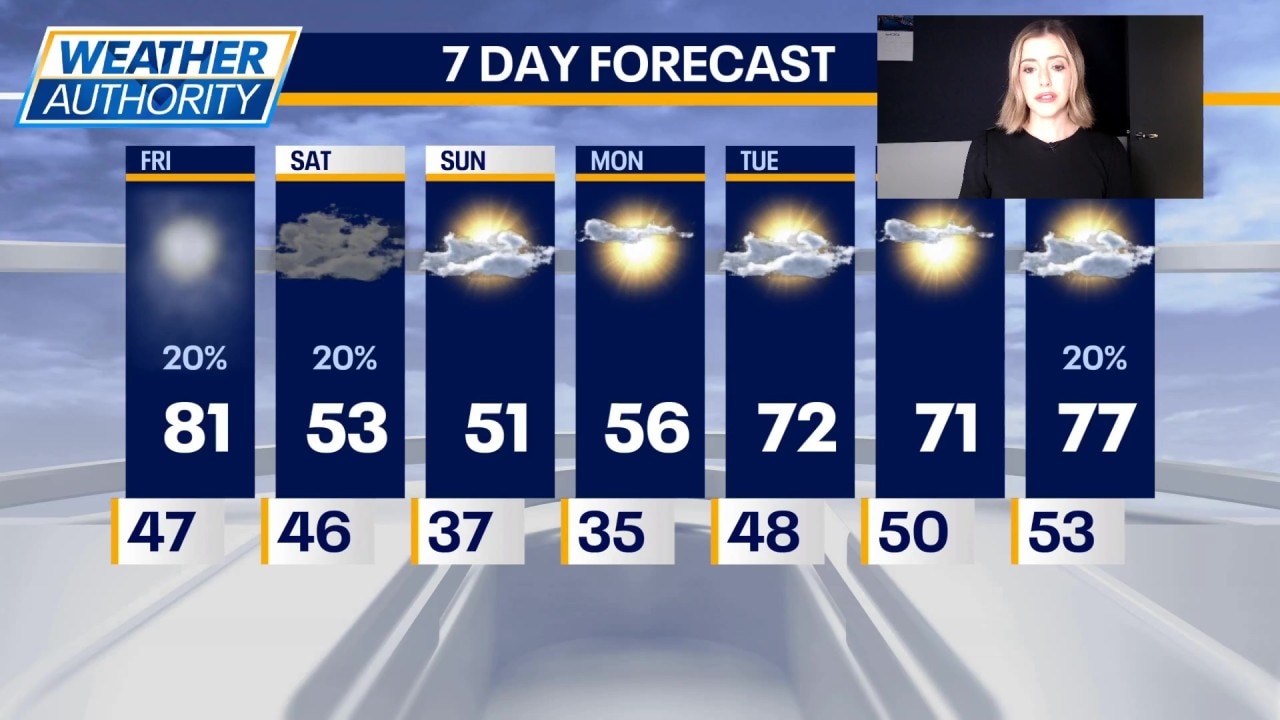
We start with a Dense Fog Advisory until 10 a.m. It will be a warm day with highs around 80 degrees under partly sunny skies. The wind will be gusty up to about 30 mph.
Severe storm threat
What to expect:
The chance for severe storms unfortunately returns this evening and tonight with all hazards possible. The Chicago area is under a Level 3 of 5 severe weather threat. The main danger will be damaging winds but there is the possibility of tornadoes.
The best chance for storms will be roughly 5 p.m. to midnight. The best chance for tornadoes will be near I-39 points west.
What's next:
The chance for rain continues after the storms, tonight into early Saturday. The skies will be clearing on Saturday with highs in the low to mid 50s. It will be gusty again tomorrow with those speeds to 30 mph.
Sunday will be cooler, but quiet. We are looking at mostly sunny skies and highs in the low 50s.
There is a chance for frost Sunday night into early Monday. Monday will be sunny with highs in the upper 50s.
Partly sunny and warmer Tuesday with highs in the low 70s. Wednesday will be mostly sunny with highs in the low 70s. We may be back to the upper 70s by Thursday with mostly sunny skies.
The Source: The information in this report came from Fox Chicago Meteorologist Kaitlin Cody.