

Chicago weather: Severe storms, tornado risk return Wednesday
CHICAGO - Rough weather is on the way, especially Wednesday. There is the potential for a repeat of last Thursday in parts of our area. It is time to once again be weather ready.
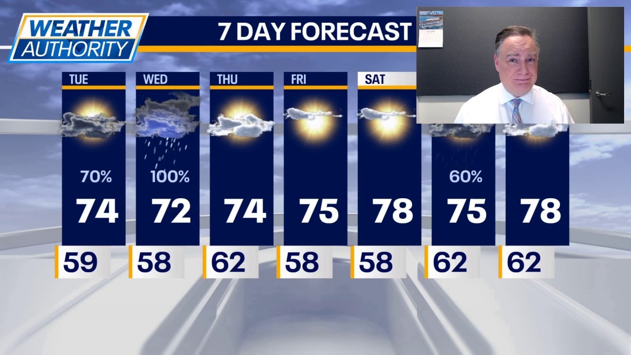
Today there is a risk of thunderstorms, particularly mid to late afternoon east of Interstate 57 for the most part. Any shower or thunderstorm activity prior to that, including this morning, would be of the garden variety. In between those rounds, it will be mostly cloudy with highs in the low to mid 70s.
Tonight will be relatively quiet under partly to mostly cloudy skies with low temperatures not far from 60.
What's next:
Tomorrow is a concerning day, especially in the afternoon and early evening. I expect an area of showers and thunderstorms to be rumbling through our viewing area during the morning hours. At this point, it does not appear as though severe weather would accompany that. However, heavy rainfall could be a concern. The show happens during the afternoon and early evening. Chicagoland is once again highlighted for an all-hazard outbreak, including tornadoes. The highest chance for significant tornadoes will be south of Interstate 80. This does not mean the tornadoes cannot occur elsewhere in our area.
I would pick 2 p.m. until 8 p.m. as prime time for these stronger storms, which can have damaging straight-line winds, hail and torrential downpours as well as the tornado risk.

Thursday, Friday and Saturday look quiet with highs rising from the low 70s on Thursday to the upper 70s on Saturday. Showers and thunderstorms return to the forecast on Sunday.
The Source: The information in this forecast came from FOX Chicago's Mike Caplan.