

Chicago weather: Severe weather threat returns this week
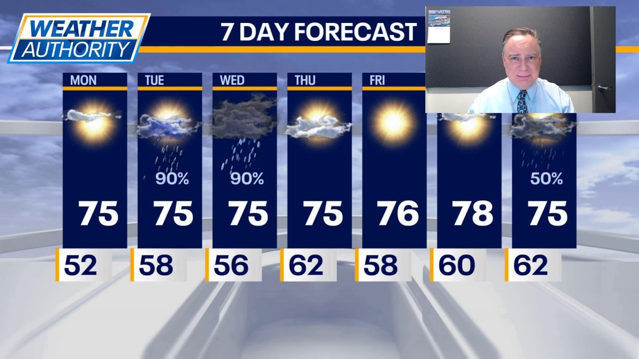
CHICAGO - We had two days of severe thunderstorms last week and there are two days this week which warrant our attention.
Today will not be one of them. Skies will be mostly sunny and it will be pleasant with highs in the mid 70s. Tonight will be partly cloudy with lows in the mid to upper 50s.
What's next:
The first round of showers this week arrives Tuesday morning. This will be followed by a few hours of clearing, allowing temperatures to rise into the mid to upper 70s. During the afternoon, a front will cross the area, sparkling showers and possibly some strong thunderstorms. The primary threats are heavy downpours and gusty winds. This is not a tornado situation.
On Wednesday it will be partly sunny in the morning but then a disturbance will roll in from the northwest, which could lead to strong thunderstorms in the late afternoon and evening. Chicagoland is in a level two "slight risk" for severe thunderstorms with all hazards being in play. The enhanced risk of severe thunderstorms, level three, is south of the Kankakee and Illinois River valleys. Wednesday is clearly the day to be most concerned for severe weather in the p.m.
The rest of the week looks quiet with clearing skies on Thursday and highs in the mid 70s. On Friday it will be sunny and pleasant with highs again in the mid 70s.
The Source: The information in this forecast came from FOX Chicago's Mike Caplan.