

Chicago weather: Showers move in before dry, cool Sunday
CHICAGO - Chicago will see periods of rain and thunderstorms heading into Easter weekend, but conditions are expected to improve in time for Sunday.
Showers moved into the area Friday evening, with some thunderstorms producing heavy downpours. The primary concern overnight would be soaking rain rather than severe weather, as the threat for stronger storms, including possible tornadoes, has diminished.
LATEST UPDATES:
- 9:40 p.m.: Flash Flood Warning including New Lenox IL, Mokena IL and Bourbonnais IL until 2:00 AM CDT
Temperatures reached a high of 62 degrees Friday, above the seasonal average of 54. By late evening, temperatures had fallen to around 41 degrees, with east-northeast winds near 15 mph off Lake Michigan helping limit the chance of storms in the Chicago area.
A sharp temperature contrast remained across the region, with readings in the upper 30s near the lake and mid-50s farther south.
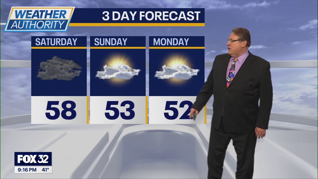
Rain is expected to continue overnight into Saturday morning before gradually tapering off. Skies should begin clearing by midday Saturday, with lingering showers possible in northwest Indiana.
Sunday is expected to remain dry, with a mix of clouds and some sunshine and temperatures in the low 50s. Conditions will stay relatively cool through Monday before warming into the 60s by midweek. Additional chances for rain are possible later in the week.