

Chicago weather: Storm chances return Wednesday before summer heat builds
Storm chances return Wednesday before summer heat builds across Chicagoland
Mike Caplan has your Chicago weather update!
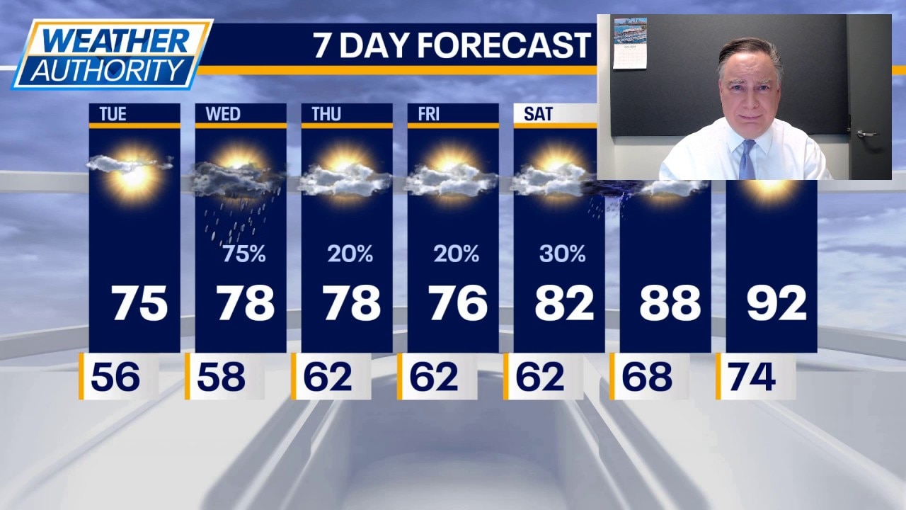
CHICAGO - It’s a clear and cool morning with temperatures areawide in the 50s. With plenty of sun, temperatures will climb into the mid, maybe upper 70s. That will still be a few degrees cooler than normal.
What may come as a surprise is the fact that June as a whole is 1° warmer than normal, despite how relatively cool it has been lately.
What's next:
The next storm system arrives Wednesday. With it comes a chance of showers and thunderstorms. The first wave might move into our northern counties during the morning. A second wave is likely late in the afternoon and into the evening anywhere in our viewing area. Highs tomorrow won’t be far from 80° in between the showers.
Most of the rain chances Thursday and Friday, I think, will be south of our viewing area. It is conceivable that there might be a slight northward shift to some of that activity into our southern counties, but most of our area will remain dry heading into the weekend.
Fans of summer heat will be pleased with the direction the weather is headed this weekend and especially next week. On Saturday we will be in the low 80s and on Sunday we will be in the upper 80s. There’s a small chance of a shower or thunderstorm Saturday night, but most of the weekend is dry.
And then it gets hot. And I mean hot. Highs for much of next week will be well into the 90s and there will be enough humidity to boost those heat indexes up to around 100 or beyond.
The Source: The information in this forecast came from FOX Chicago's Mike Caplan.