

Chicago weather: Warmup starts today before storms and sharp cooldown
Chicago weather: Wednesday morning forecast
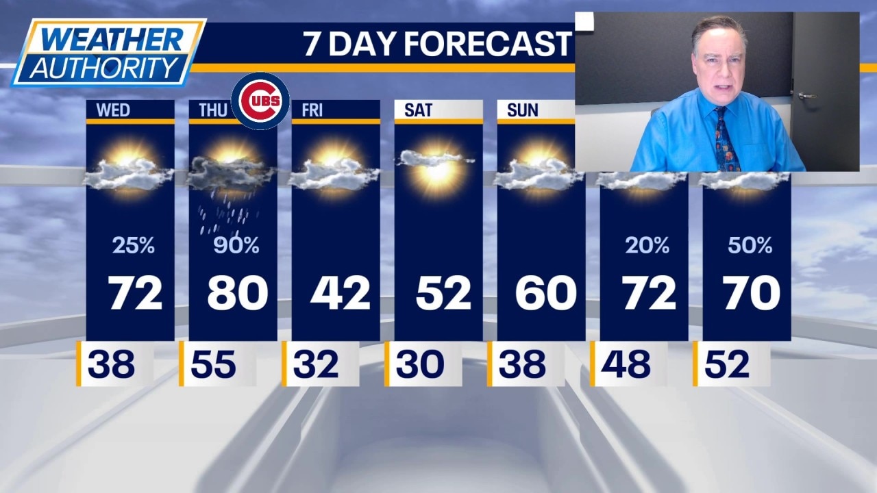
Fox Chicago Meteorologist Mike Caplan breaks down today's weather outlook.
CHICAGO - Tomorrow is going to be a challenging day, weatherwise. More on that in a moment, but first, let’s deal with today.
Timeline:
Chicago skies will end up partly sunny, enabling temperatures to soar. I’m taking my forecast number even higher than I had yesterday with a very good chance of hitting 72° this afternoon. Winds will pick up out of the south between 10 and 20 mph.
Tonight will be mostly cloudy and mild with lows in the low 50s. There’s a chance for an isolated shower or thunderstorm perhaps focused over our southern counties.
Tomorrow will be even warmer with highs hitting the low 80s over much of our viewing area. The record is 79 degrees set in 2007. It will turn significantly cooler during the afternoon north and near the lake. This will impact baseball at Wrigley field, where the wind will start to blow in and temperatures will fall into the 50s.
The main concern tomorrow will be with the risk for severe thunderstorms with all hazards possible. Prime time will be between 4 p.m. and 10 p.m. as a cold front plows through. This will lead to a rapid drop in temperatures. Primary hazards will be large hail and damaging straight-line winds but a tornado can’t be ruled out.
Friday will be 40° colder than Thursday with highs barely past 40 degrees. Skies will become mostly sunny. At least the cold punch is brief with 50s returning on Saturday under mostly sunny skies. On Sunday it will hit 60 degrees with a little bit more cloud cover around. Then temperatures continue to climb to 70° plus on Monday.
The Source: The information in this report came from Fox Chicago Meteorologist Mike Caplan.