

Chicago's ice and snow status
Chicago - Chicago caught up quickly after a slow start this winter in terms of our snow and ice. We were well below average for both snowfall and the amount of ice cover on Lake Michigan through all of December and into the start of January.
Let's look at the snowfall first. So far this winter Chicago has had 21.9" of snow which is a half inch above average at this point. That is amazing considering we set the record this year for going furthest into winter without measurable snow. It finally arrived on December 28th but the month ended up with just under two inches of snowfall which was nearly five inches below average. We did a lot of catching up in January with 13.9" of snow compared to an average of 11.3" for the month. February has also started off well above average with 6.1" so far compared to an average to date of 2.5" for this month.
Speaking of snow…
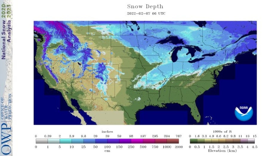
38.6% of the country was reporting snow cover as of yesterday with an average depth of 4.2". That is slightly less compared to last year at this time. On February 6th of 2021 45.9% of the country had snow cover with an average depth of 4.2".
Lake Michigan's ice cover started off below average in December and stayed there into the start of January. It has spiked a few times above average since then and now sits just below average. The latest analysis shows just under 25% of the lake has ice cover after a peak in late January of nearly 34%.
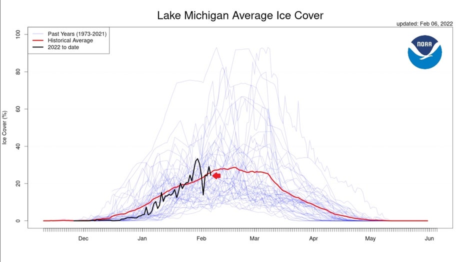
The bigger picture of the Great Lakes as a whole shows the most ice cover since 2018. The latest analysis has 41.4% of the Great Lakes with ice cover. That is more than three times the amount last year at this point (12.6% ice over) and more than six times compared to 2020 (6.3% ice cover).

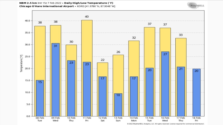
The forecast for the next two weeks or so suggests more ice melting on Lake Michigan and less snow compared to average. The GEFS daily high and low temperature forecast is warmer than average overall. 7 of the next 10 days have highs of 32° or warmer.
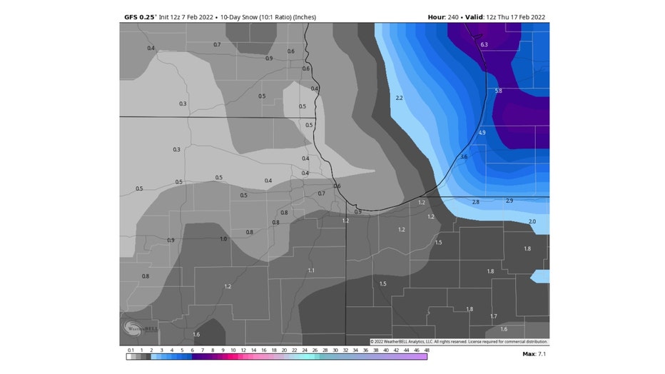
The GFS model 10-day total snowfall accumulation forecast squeezes out between about a half inch to a little over an inch.
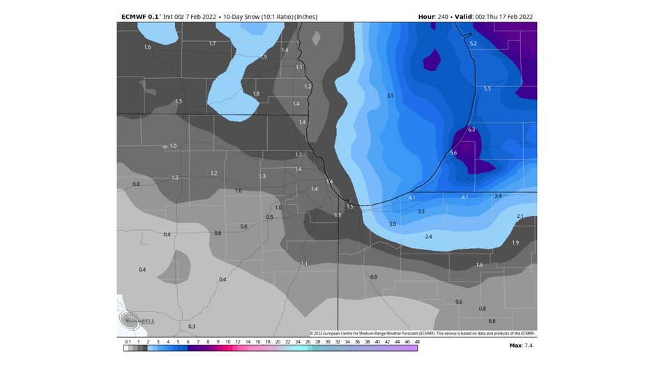
The ECMWF (European) model squeezes out even just a bit more snow over the 10-day period. It suggests around a half inch to nearly an inch and a half of snow could be coming by the middle of the month. The average amount of snow we normally receive during this period is about 4.4" so both models keep us well below average.
Ice and snow may struggle a bit over the next couple of weeks if these forecasts verify. The one thing for certain is that meteorological spring is just three weeks away!