

Countdown continues to possible Chicago snowstorm
Chicago - While the focus for this week may be on snow for most of us, we can't forget about the possibility of flooding prior to the rain transitioning to snow Wednesday night. The National Weather Service is cautioning that there is "a half inch to locally an inch of snow water equivalent remains locked in snow pack across portions of the Kankakee, Illinois, Vermilion, and Iroquois River basins".
Warmer temperatures in advance of Thursday's storm will melt off most of that snow starting Tuesday night. An inch to an inch and a half of rain could fall on top of that by Wednesday night. Flooding in low-lying areas and areas with poor draining would be likely in that scenario. In addition, ice jams could lead to more flooding issues.
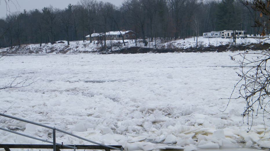
Minor ice jam flooding on the Menominee River in Marinette County on January 8, 2016. (courtesy of Eric Burmeister)
Rain should change over to snow Wednesday night with some freezing rain and sleet possible. Confidence is high for an icy period but how long it will last is still uncertain.
A prolonged period of snow sustained by two low pressure systems could produce a snowstorm with high impact for the Chicago area starting Wednesday night and lasting through most of Thursday.
An array of models is suggesting 8 inches to 14 inches of snow is possible at O'Hare.
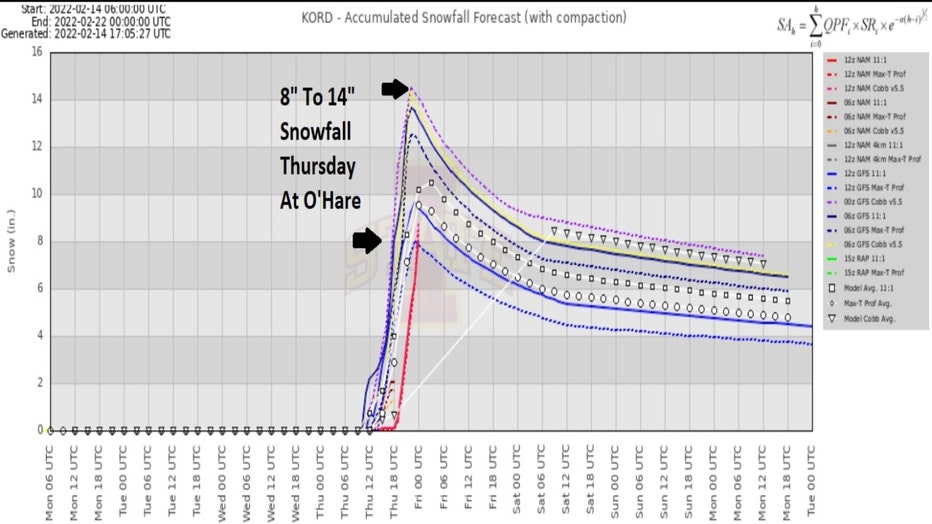
Thursday's Snowfall Forecast From Several Models
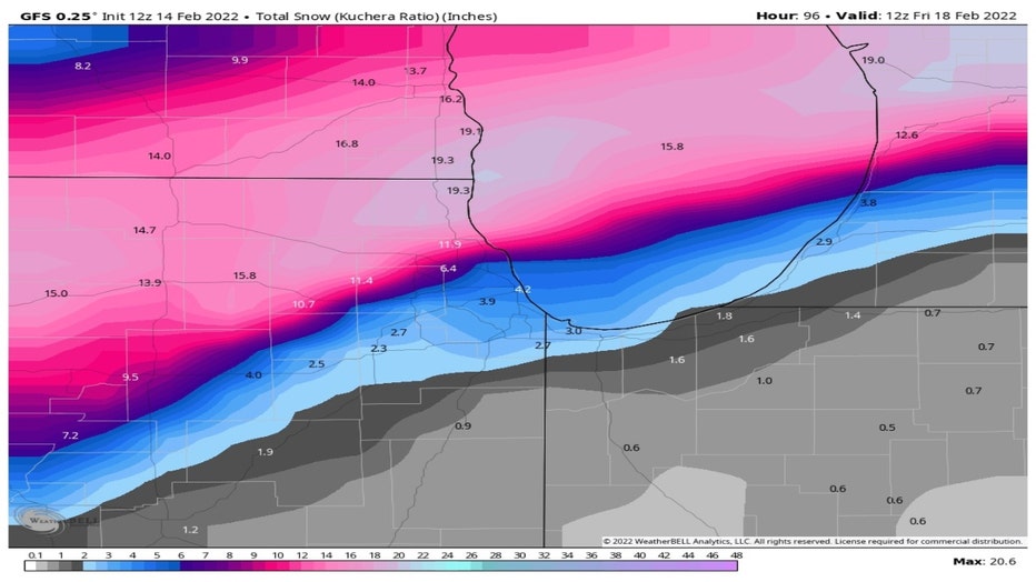
The GFS model has now shifted the axis of heaviest snow north of the city where up to a foot and a half of snow is forecast. Too early to make an exact forecast of snowfall amounts since another major model spits out significantly less snowfall.
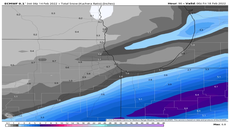
The ECMWF, or European model, still is suggesting a lot less snow. Please keep in mind this model runs only through Thursday evening while the GFS model includes any snow from that point through Friday morning. Still, the European Model only squeezes out about an inch to an inch and a half for most of us with heavier amounts well south of the city.
We will keep a close meteorological eye on this potentially messy storm. For now, I just wanted to get this on your radar, pun intended.