

So long 90s as cooler pattern kicks in for Chicago
CHICAGO - July-like heat broke records at many locations across northern Illinois last week including O'Hare, Midway and Rockford.
The heat hit hard Wednesday at O'Hare as the high reached to 90 degrees to break a 40-year-old record. It was the earliest 90-degree day we have seen in over 10 years. The heat was accompanied by unusually high humidity for early to middle May too.
The dew point is a measurement of the amount of moisture in the air. The dew point in Chicago climbed to 73 degrees last Wednesday as heat index values climbed well into the 90s. Before that, the earliest on record we have seen a dew point that high was on May 16th of 1974.
DOWNLOAD THE FOX 32 WEATHER APP
For those of you who don't like it that hot, I have some good news for maybe the next two weeks or so.
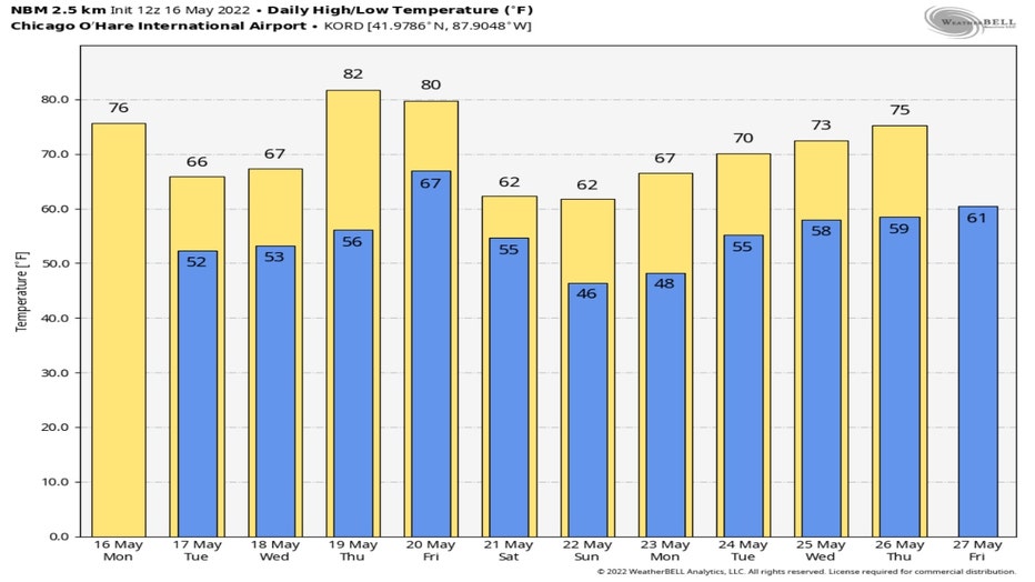
So long to highs in the 90s at least through Thursday next week. The National Blend Of Models long range forecast has highs sliding from the 70s today and then down into the 60s for Tuesday and Wednesday.
Thursday and Friday may hit 80 degrees or more before we settle back into the 60s from Saturday through Monday. We start to warm back up by the end of next week with highs in the middle 70s by a week from Thursday.
Average highs for the middle of May are in the lower 70s and then warm into the middle 70s by the end of the month.
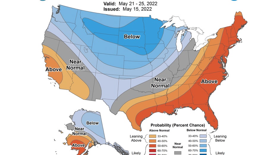
Both the 6-10 day and 8-14 day temperature outlook forecasts from the Climate Prediction Center have us "leaning below" normal. The 6-10 day forecast covers the period of this Saturday through the following Wednesday.
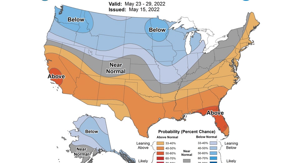
The 8-14 day forecast covers the period from a week from today through Sunday of Memorial Day Weekend.
Enjoy this relatively mild period while you can if you are not a fan of hot and humid weather because most models still point to a steamy summer.