

A sensational start to September for Chicago
CHICAGO - August ends with awesome weather on Wednesday and September will begin with a sensational start.
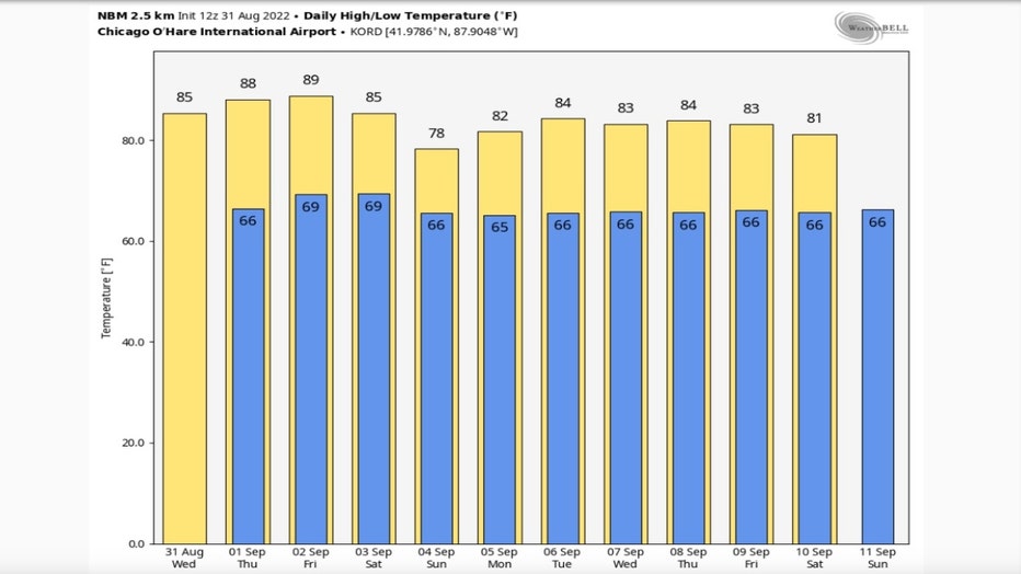
Highs will climb into the middle 80s for the last day of the month and that will seal a warmer than average summer. June ended up 1.6 degrees above average while July was barely below average, it came in just a tenth of a degree below normal overall. It looks like August will end up around a half of a degree above average for the month.
The hottest day of the summer was on June 21 when the high hit 99 degrees. We have had 16 days so far this year with a high of 90 or hotter. We average around 17 90 degree days per year. September normally produces another two of them.
Sept. 1 is the start of meteorological fall and we should get off to a warm start. The National Blend Of Models has the month starting off warm with 10 of the next 11 days forecast to be above average. Average highs fall from 80 degrees for the end of this week to the upper 70s by a week from Saturday.
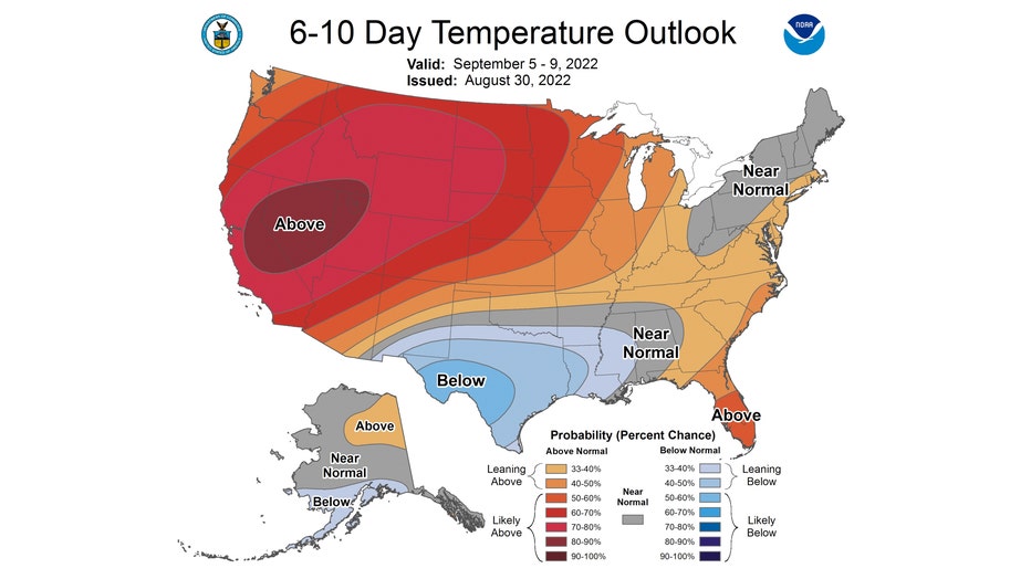
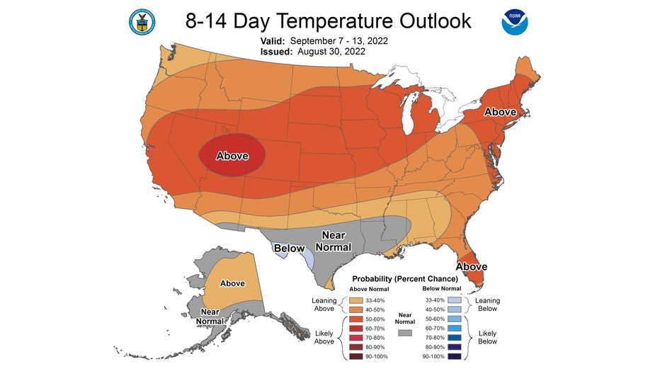
The Climate Prediction Center's 6-10 day and 8-14 day temperature outlooks keeps this warm pattern coming into the middle of the month.
The 6-10 day outlook has us "leaning above" average overall from Labor Day through the following Friday.
The 8-14 day outlook has us "likely above" average overall from next Wednesday through the following Tuesday.
SUBSCRIBE TO FOX 32 ON YOUTUBE FOR MORE CONTENT
The longer range precipitation outlooks both favor us for a drier than average pattern. We are outlooked to be "leaning below" normal with precipitation overall from Labor day through the following Friday.
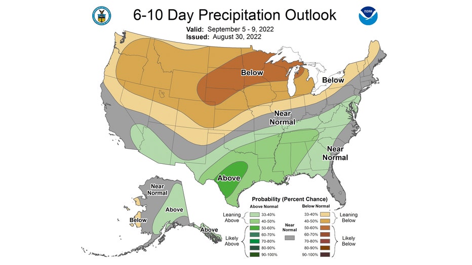
The relatively dry pattern could continue into nearly the middle of September.
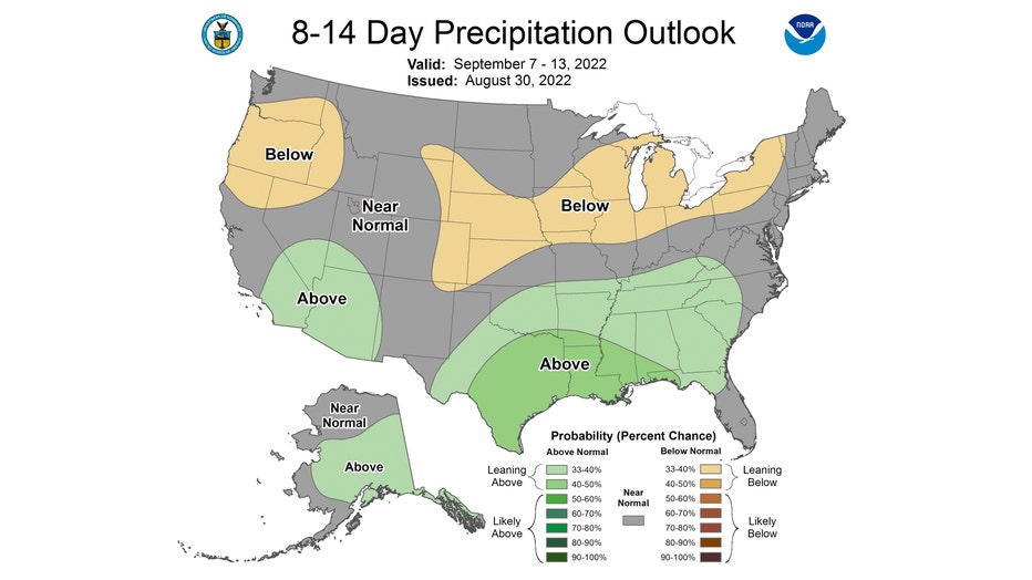
The 8-14 day outlook has us "leaning below" average overall for rainfall from next Wednesday through the following Tuesday.