

Chicago weather: Chilly nights, frost possible before warmup
CHICAGO - We've seen some very isolated to spotty showers pass through the area today. That activity ends and then overnight the sky tries to clear out. The bigger issue for most of us: chilly air. Temperatures look to tumble into the upper 30s for many tonight. Toss in any kind of wind and it's going to feel even colder.
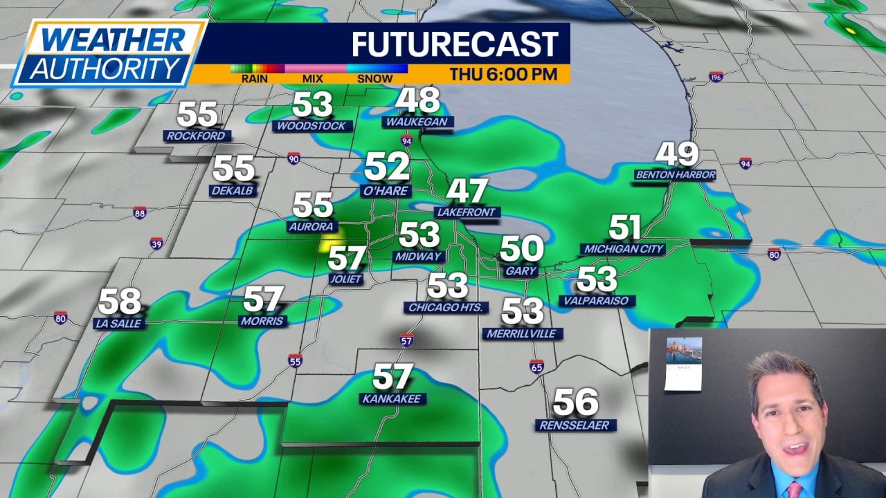
It will remain cool through the day Thursday with highs in the middle 50s for most. Those closer to the lakefront may struggle just to see 50, while those farther south and west may be able to tag 60. More showers are possible Thursday, especially in the afternoon and evening. No big thunderstorms are expected, but some scattered showers appear likely for several locales.
Heads up for Friday and Saturday mornings as we may be dealing with widespread frost across the area. Morning temperatures will easily be around the freezing point for numerous people. Frosty air is not totally uncommon in May; the latest 32 degree reading in Chicago history came on the 25th of May back in 1992.
Daytime temperatures will continue to hang in the 50s for Friday and Saturday.
Then, as we go into Sunday, we should start to feel some warmer air. Expect highs to climb well into the 60s Sunday with a partly cloudy sky. We could see highs return to near 70 for Monday and Tuesday with a fair amount of sunshine. By Wednesday, clouds and a chance for rain may knock highs down a bit, lower 60s for many.