

Chicago area under flood watch with potential for severe weather Monday afternoon

Chicago weather: Flooding and severe storms possible today
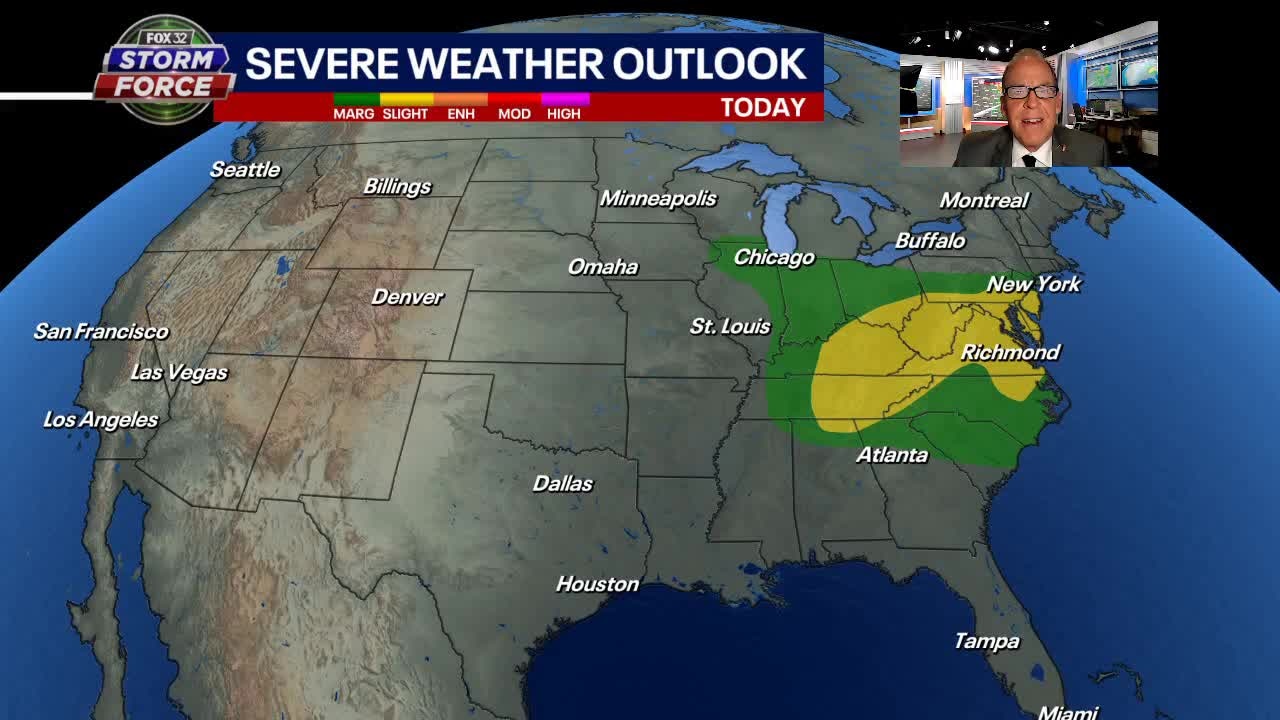
FOX 32s Mike Caplan breaks down todays stormy weather outlook.
CHICAGO - A flood watch is in effect for the Chicago area and northern tier of Illinois counties Monday where the risk of heaviest rainfall is most likely.
Showers and storms will move in by late Monday morning and continue off and on into the evening with some areas seeing as much as two inches of rain.
There remains a small threat of severe storms Monday afternoon with Chicagoland in the "marginal risk" area, per the Storm Prediction Center. The potential will be greatest between about noon to 6 p.m.
Highs on Monday will be in the mid to upper 70s
SUBSCRIBE TO FOX 32 ON YOUTUBE
Tuesday starts cloudy then clears out during the afternoon. Highs will be in the mid to upper 70s.
Chicago weather: Stormy start to the week then settling down
FOX 32's Tim McGill breaks down today's stormy weather outlook.
It will be generally dry for the rest of the week with only a small chance of a shower or storm Thursday morning, with highs in the lows 80s.
Then, the forecast focus shifts to what is growing increasingly likely to be the hottest weather of the year starting this weekend with highs in the low 90s and continuing into next week.