

Chicago weather: Frost possible tonight before gradual warmup into weekend
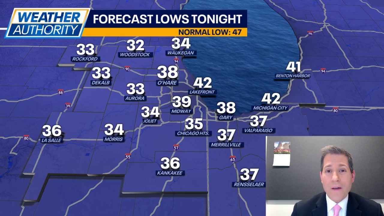
CHICAGO - While we got to see a little sunshine earlier today, it didn't help our temperatures. And now tonight, as the sky clears out, our temps are going to take another tumble. Similar to last night, we'll likely see some pockets of frost across our northern locales. The difference for tonight is that those along and south of I-80 may also end up with frost. Expect lows around 34 to 36 degrees in many spots.
Sunshine (and chilly air) greets us on Thursday morning but then clouds increase through the morning and into the afternoon. It's possible we see a few spotty to scattered showers by the middle of the afternoon. No severe weather is expected, but don't be surprised by a heavier shower in some spots. Highs on Thursday should end up close to 60 in most cases and the wind will be from the west around 10-20mph.
Friday brings us another shot at some spotty showers, but it won't be all day. Expect afternoon temperatures to reach the lower and middle 60s with a southwest wind around 10-15mph.
The weekend is trending drier at this point, which is great news for Mom. Saturday will still be the peak day with sunshine and highs around 75. Sunday brings a little more cloud cover and some slightly cooler air, still highs will reach the 60s. Both days will be breezy with wind speeds around 10-15mph.
As we move into next week, expect lows in the middle 40s and highs in the low to middle 60s. There is a chance for a few showers on Tuesday. And then by the very end of the week, it's possible highs soar into the 70s. It's finally going to feel more like May around here (and stay that way).