

Chicago weather: Rollercoaster temps this week and several more rounds of rain
Chicago Weather: Rollercoaster temps this week and several more rounds of rain
Fox Chicago Chief Meteorologist Emily Wahls has the forecast for March 31, 2026.
CHICAGO - It has been a busy Tuesday with rounds of rain and storms, and several reports of large hail in Chicagoland. The severe weather threat is diminishing as the hours tick by this evening, although a Severe Thunderstorm Watch remains in effect until 11 PM for LaPorte County in Northwest Indiana.
The strong cold front triggering today's stormy weather pattern is dramatically dropping temperatures this evening. Previously this afternoon, temperatures soared into the upper 60s and 70s. Plan for lows to fall into the mid 30s tonight, which is fairly seasonable for the end of March and early April.
Looking ahead:
Scattered rain and possibly a few thunderstorms remain possible on Wednesday with highs only in the mid 40s. Northeasterly winds will be gusty through the day, likely gusting to around 25 mph.
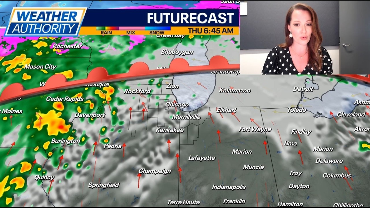
A warm front will surge northward again late Wednesday night into Thursday, sending temperatures into the 60s and 70s again during the day on Thursday. Along with the warm-up will come another round of showers and storms. Scattered strong to severe storms will be possible on Thursday.
Friday looks mainly dry, but a few stray showers could develop. Temperatures will be in the upper 60s for highs. Another round of rain arrives on Saturday with highs in the 60s.
Easter Sunday looks cool with highs only in the upper 40s to low 50s. Skies will be mostly cloudy to partly sunny.