Fine-tuning Friday's forecast for snow in Chicago
CHICAGO - The ingredients are coming together for some sticking snow starting late Thursday and continuing into Friday. A cold that crossed through this morning will continue to settle south of the city Wednesday.
A system will pull out of the plains later today and move eastward into the Midwest late tomorrow in the colder air. Snow could start as early as late Thursday afternoon. The bulk of the snow would fall from around midnight to 10 am Friday.
I have been posting about the potential snowfall all week. I have noticed some trends. The models have been moving the snow more south and decreasing the amount.
DOWNLOAD THE FOX 32 WEATHER APP
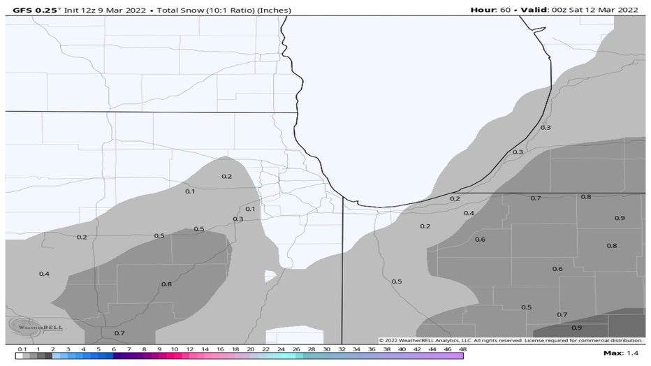
The GFS Model has almost dried up. It has a trace to a couple tenths of an inch well west and south of the city. Most of us wouldn't even need a scraper.
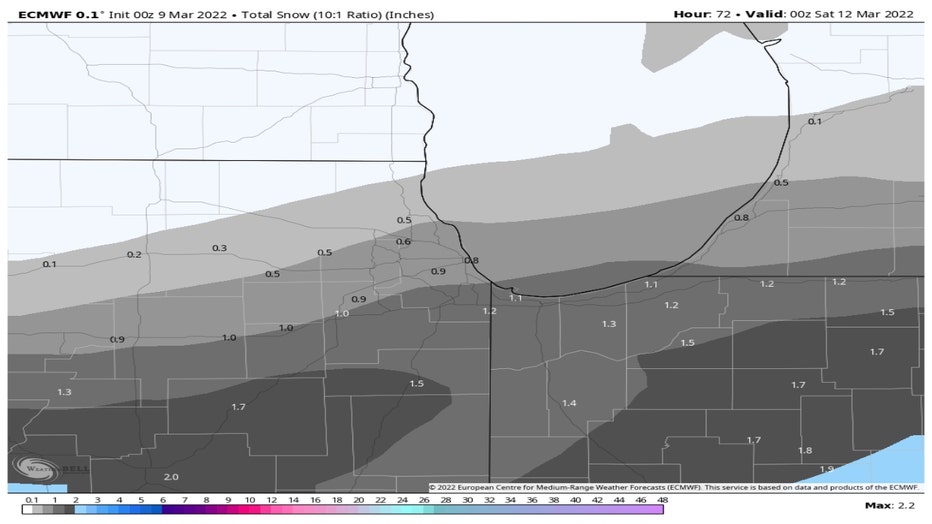
The European model is calling for half inch to an inch for most of the area with up to 1.5 inches well south of the city. It doesn't have any snow forecast for our far northern and northwestern suburbs. This latest run has less snow coming compared to yesterday's model run and it has pushed the snow a bit further south.
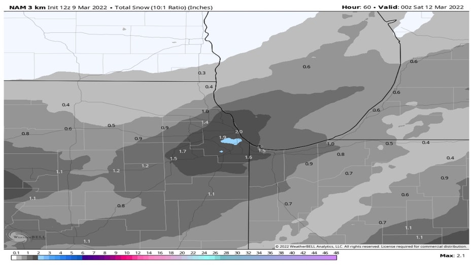
The NAM Model spits out one to two inches of snow for most of the area with a few spots getting a bit over two inches in Chicago's South and West sides.
After careful consideration, my hunch is that our far northern suburbs won't get anything more than a dusting. Most of the area could pick up a half inch to an inch with a few spots in our southern suburbs receiving about two inches of new snow.
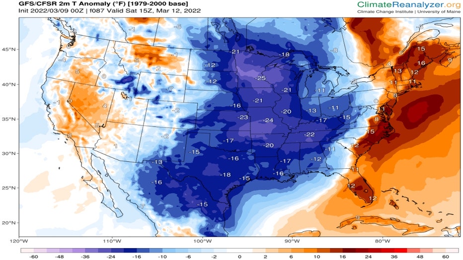
The models have been remarkably consistent with the cold that is coming. Most of the middle of the country will be around 15 to 20 degrees below average by Saturday morning. That means lows Saturday morning here as cold as the high single digits north and west of the city and the middle teens in Chicago itself. Highs Saturday will only reach into the middle 20s.
Climatereanalyzer.org
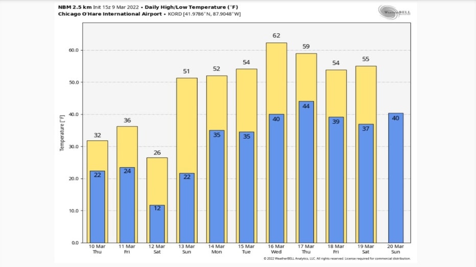
The National Blend Of Models continues to advertise a big warm up for next week. The latest forecast of daily highs and lows is even warmer than previous forecasts. It now has our highs warming into the 50s starting Sunday and lasting through at least the following Saturday. Wednesday would be the warmest day during the period with highs in the 60s.
Could the cold and snow coming be winter's last hurrah? I for one hope so.