

Tracking different types of precipitation for Chicago
Chicago - I'm continuing to track a potpourri of precipitation types for Chicago over the coming days. My prior post listed several types of weather to expect and today I add a new one. Small hail is possible with some thunderstorms that could develop late tonight into Tuesday. So the variety of precipitation this week now includes patchy fog, rain, thunderstorms, small hail, freezing rain and finally, snow.
We saw some patchy fog today and tonight. Tuesday is the best chance for rain and a few embedded thunderstorms.
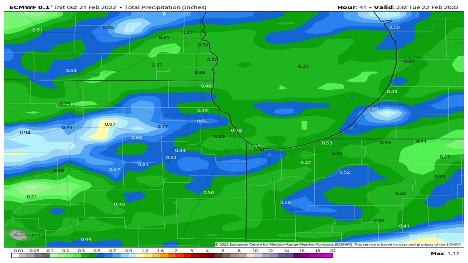
The European model drops between a third of an inch of rain to nearly an inch across the area through Tuesday evening. The frozen ground means there will be a lot of runoff into streams and rivers. In particular, spots that see locally heavy rain from thunderstorms will be prone to at least some minor flooding.
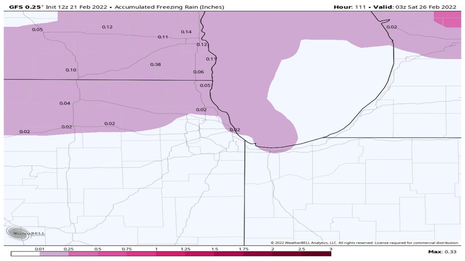
Freezing rain may fall Tuesday afternoon into the evening mainly north and northwest of Chicago. The GFS Model keeps the ice accumulation to less than a tenth of an inch. That would make for some slick spots but any surprises in terms of additional freezing rain not forecast could cause bigger issues. Southern Wisconsin has weather advisories because up to two tenths of an inch of ice accumulation is possible.
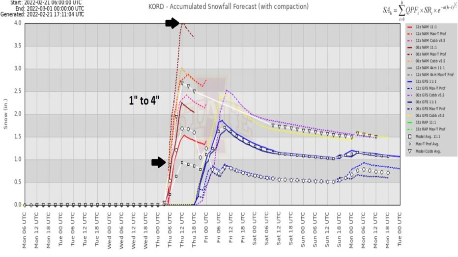
The early (and I want to emphasize the word early) snowfall numbers aren't exactly forecast a snowpocalypse but enough sticking snow to slow us down late Thursday into early Friday. The GFS model spits out around three to four inches for most of northern Illinois with around five inches in northern Indiana and even higher amounts south of there. We will refine the numbers closer to the arrival of snow so stay tuned.
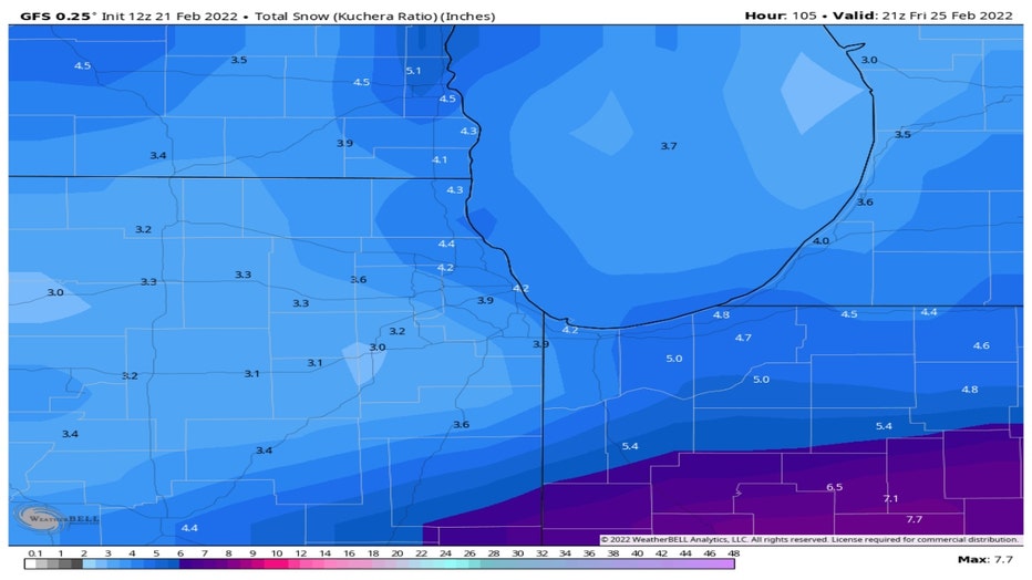
The European model doesn't squeeze out as much snow. It is forecasting more like one to three inches for most of the area. The bulls-eye though for the heaviest snow is similar to the GFS model. It lays down the heaviest snow in north central Indiana.
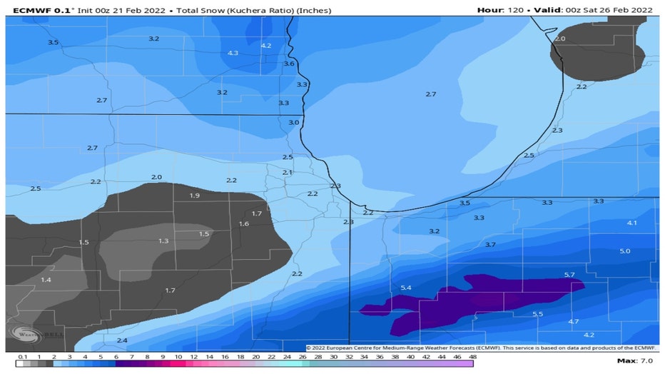
We have seen 25.3" of snow so far this winter which is just 1.7" below average. This week's snowfall may bring us back to just about average for the season. A meteogram that shows several different model solutions for the upcoming snow has a range of around one to four inches for O'Hare. Some models bring it in a little earlier in the day on Thursday while others hold it off until later in the afternoon.
The one thing that as been consistent wit the models is the fairly dramatic drop in temperature coming this week. Temperatures tumble on Wednesday with highs almost 20° colder than Tuesday. We then stay below average through Monday.
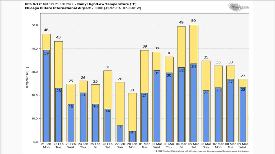
The good news is that meteorological spring is just a week away. March begins on Tuesday and right on cue we bounce back just a bit above average. The first weekend of March could definitely feel more like spring with highs maybe climbing to near 50°.