

Chicago weather: Chilly Monday gives way to big warmup
Chicago weather: Monday morning forecast
Fox Chicago Meteorologist Mike Caplan breaks down today's weather outlook.
CHICAGO - A major pattern change is in the offing starting later this week.
For the time being, however, it will remain cool today with some spots far north and west likely waking up to frost once again.
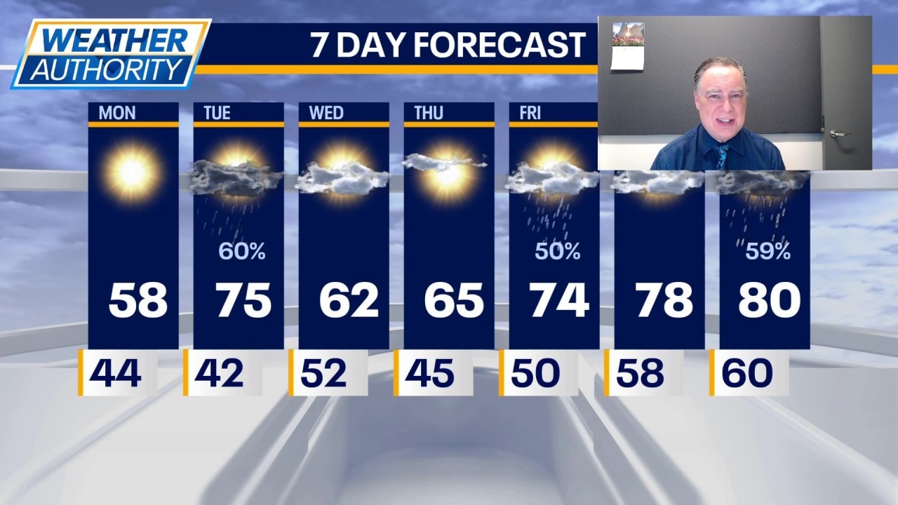
The rest of the day will be sunny but unseasonably cool with highs in the mid to upper 50s—cooler near the lake. Unfortunately, the risk of yet another frost cannot be ruled out in our far-northern counties tonight. The key to avoiding that will be the arrival of clouds. If they can move in soon enough, then frost will be prevented.
Chicago weather forecast
What's next:
Tuesday will be warmer with highs in the low to mid 70s. There will also be scattered showers and perhaps a few p.m. storms in the area. That activity will be tied to a cold front which will knock temperatures down on Wednesday. Highs will be in the low 60s with partly sunny skies.
Thursday will be a bit milder with highs in the upper 60s away from the lake.
The next chance for showers will arrive on Friday as much warmer air settles in for an extended stay. Highs will be in the mid 70s with 80° within reach both days this weekend.
Showers and storms are possible on Sunday, which will hold highs below 80.
The Source: The information in this report came from Fox Chicago Meteorologist Mike Caplan.