

Chicago weather: Light snow winds down with slick spots possible early
Chicago weather: Wednesday morning forecast
Fox Chicago Meteorologist Mike Caplan breaks down today's weather outlook.
CHICAGO - I think most of us would be happy if this were the last snow of the season, but that is highly unlikely as it frequently snows even into April as we all know. However, this is the last snow in the immediate forecast.
Weather outlook:
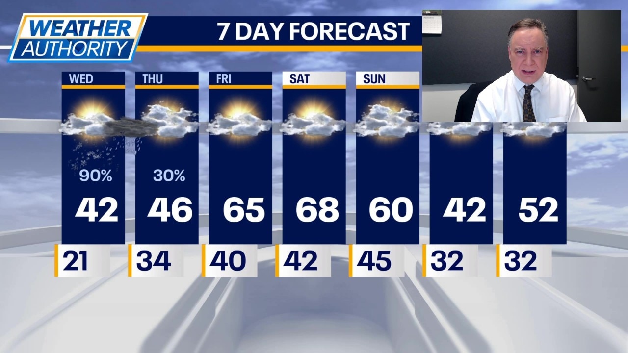
Light, powdery snow will not accumulate much this morning, but there can be some slippery spots on untreated roads given the fact that it is well below freezing.
Snow should be winding down early this morning and moving away, leaving behind mostly cloudy skies and somewhat milder temperatures than yesterday‘s disappointing 20s. There will be a spread in temperatures across the area, with low 50s possible in the Kankakee River Valley while it stays in the upper 30s across our far-northern counties, where there is more snow on the ground in general. Low to mid 40s will do it for the city.
What's next:
Tonight we’ll start out dry, but another storm system will be coming through. This one will have a chance of rain associated with it going into tomorrow morning. Rainfall amounts should be light and many areas will miss out entirely.
Residual cloud cover may hold down temperatures somewhat. I’m concerned that earlier expectations of low 50s tomorrow may go unrealized and therefore I am lowering my forecast to the mid 40s.
Much milder air will bathe Chicagoland Friday through the weekend with no precipitation expected. Highs will be in the 50s and 60s although it will end up being cooler near the lake.
There will be a quick shot of chiller air arriving on Monday before the next warming trend begins on Tuesday.
The Source: The information in this report came from Fox Chicago Meteorologist Mike Caplan.