

Chicago weather: Subzero wind chills ease as lake-effect snow shifts south
CHICAGO - Chicagoans endured another frigid January day as wind chills dipped below zero and lake-effect snow continued to impact parts of the region, though conditions were beginning to improve.
Early Friday, wind chills fell to minus 3 degrees at O’Hare International Airport and minus 4 in Rockford, with "feels like" temperatures as low as 6 degrees below zero in areas such as DeKalb and Aurora. Actual temperatures hovered near 12 degrees in Chicago, with northwest winds around 13 mph.
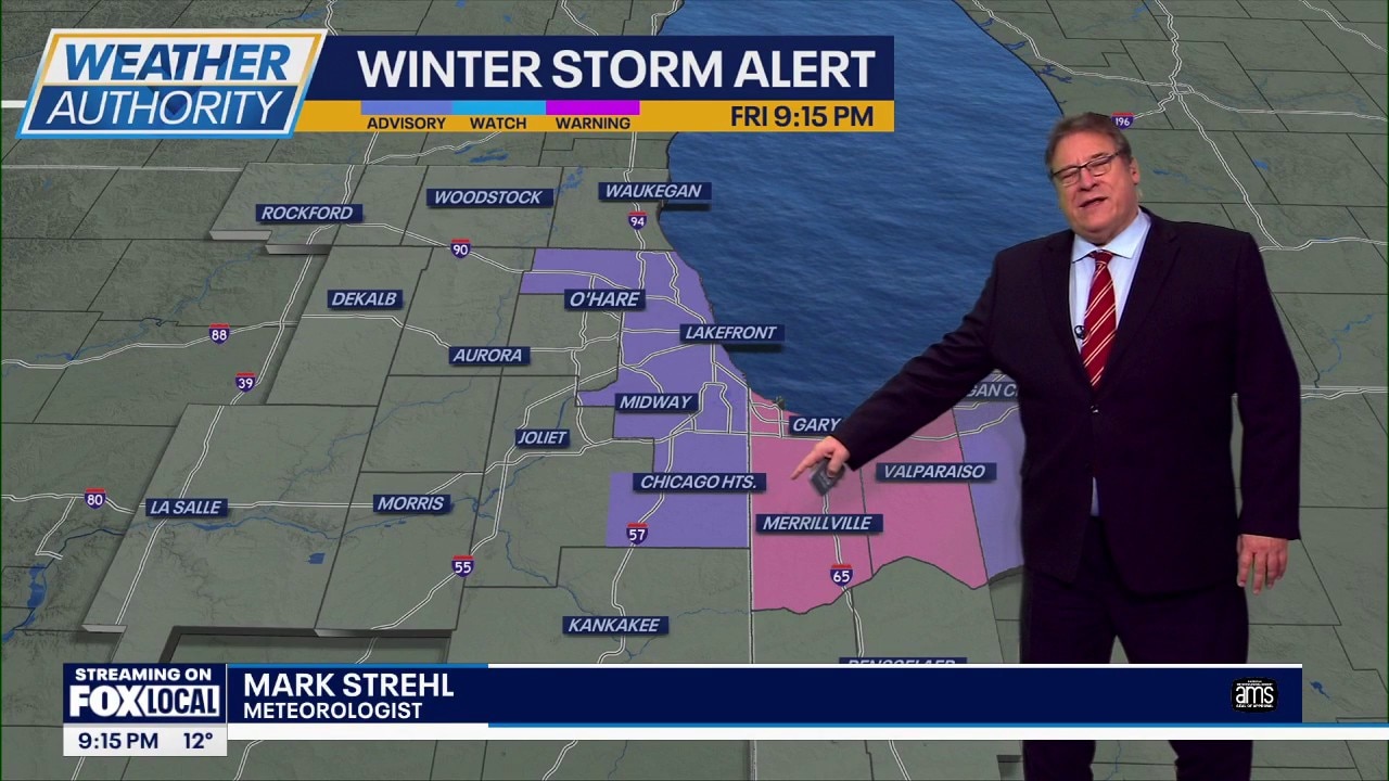
The National Weather Service downgraded Cook County from a winter storm warning to a winter weather advisory, signaling that the primary snow threat was shifting south along Lake Michigan. Winter storm warnings remained in effect for areas near the southern end of the lake, including parts of northwest Indiana, where lake-effect snow was expected to continue, particularly along Interstate 65.
Radar showed bands of lake-effect snow pushing southward, though forecasters cautioned that a secondary round of snow could briefly move back toward Chicago early Saturday before tapering off. Visibility across much of the city remained good Friday evening.
Wind chills are expected to stay below zero overnight and into early Saturday. Daytime highs Saturday should reach the mid-20s with lingering snow showers, followed by gradual improvement. Forecasters expect highs in the upper 20s to near 30 by Sunday and Monday, along with some sunshine.