

Chicago weather: Rain clears Friday ahead of possible first snow of the season
CHICAGO - Showers and thunderstorms passed through Chicagoland Friday morning. In fact, there’s some pretty respectable rain falling over southern portions of our viewing area. That will come to an end by 6 a.m. with rapid clearing taking place thereafter.
Chicago weather forecast
What to expect:
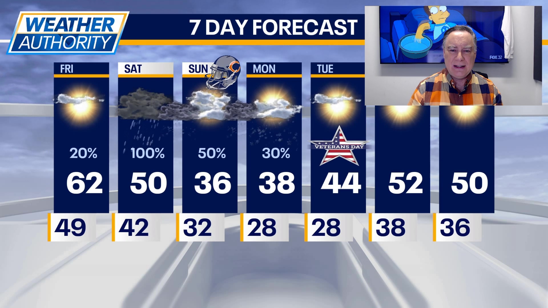
High temperatures today will make it into the low 60s with a gusty wind. There’s a small chance of a late afternoon or evening light shower.
The main forecast focus, however, remains squarely on the likelihood of the season’s first snow. The next storm system will be moving into Chicagoland tomorrow, especially in the afternoon. It will begin initially as rain. but as colder air filters in from the west late in the evening that rain will change over to wet snow.
It is doubtful that there would be much if any accumulation tomorrow night due to ground temperatures being as warm as they will be. But it is certainly possible somebody might get a slushy coating.
Highs tomorrow will reach the low 50s but temperatures will drop close to freezing at night. And then the concern is lake-effect snow. This could start at some point Sunday and if the European model is correct, would still be snowing in Chicago on Monday morning, impacting the commute.
Other models disagree, keeping snow well to Chicago’s east. What is certain at this juncture is that the coldest air of the season will arrive for Sunday and Monday when high temperatures will only be in the mid to upper 30s and overnight lows will be in the mid to upper 20s.
Temperatures do moderate starting on Veterans Day with highs in the mid 40s under mostly sunny skies. The warming trend continues for the middle and end of next week when highs will be in the low 50s under sunny skies.
The Source: The information in this report came from FOX 32 Meteorologist Mike Caplan.